Ever since we handed over our sailboat Cool Change and returned from Fiji, the most common question we get is, “So, what’s next? What is your next adventure?” I suppose it is of our own doing to have created an expectation that something is in store for us that is just as exciting as sailing a small sailboat to the South Pacific for a decade. But frankly, it is equally as satisfying for us to just do what every other active retiree does, for a change: finish those deferred maintenance items around the house, which have always nagged at us but we were never home long enough to do before; follow up on medical issues that we have been putting off for way too long; restore relationships that warm our hearts with family and friends before we loose touch completely; and find ways to keep our bodies active and our minds at ease, like rowing our catarafts down whitewater rivers, for example.
For this time around, I will spare you from notes on our progress on landscaping our side yard, our medical procedures or our family reunions, but in keeping with the spirit of adventure, here is a trip report from our recent 5 day private wilderness rafting/camping trip down the Lower Salmon River in Idaho.
The Lower Salmon River, Idaho. September 15-19, 2023
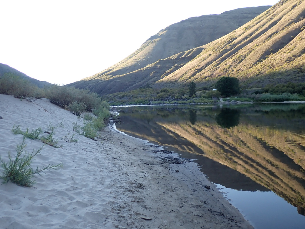
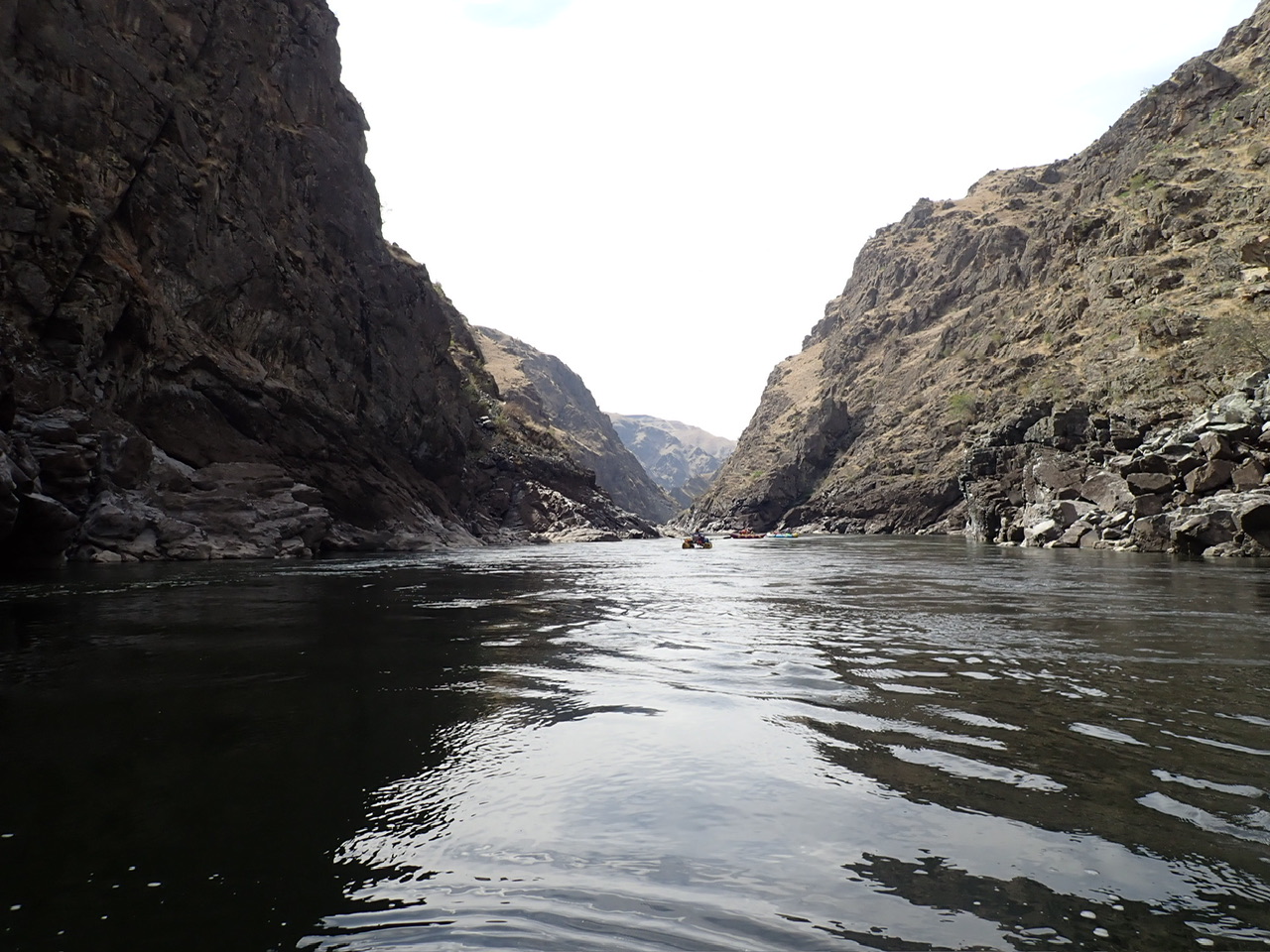
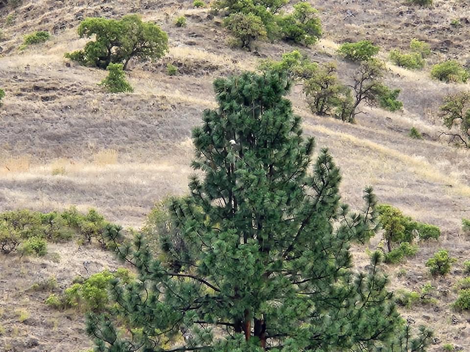
This 72-mile run has fun, big waves in multiple Class III rapids, interspersed amongst mostly gentle-moving water. The flow this time made only two to three rapids worth scouting; the rest were read-and-run. The segment we floated runs through four separate, beautiful canyons, adorned with big horn sheep, pictographs, white sand beaches and dramatic basalt cliffs. Overall it is a fun, relaxing float with just enough whitewater and wilderness to make it interesting.
I should mention, however, that if you can find a way to make the final 20 mile slog out on the Snake more pleasant, either by shortening the river hours each day, bringing a motor to mount on a transom or contracting with a jet boat to haul your gear out, it would save you that seemingly endless row without missing many rapids. (I only mildly complained when I first did it three years ago but the arthritis in my hands really protested this time.)
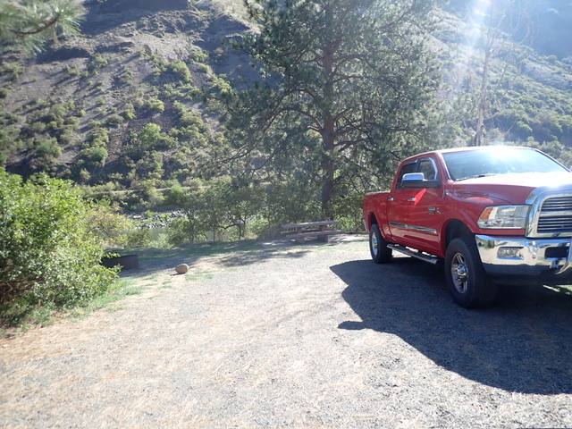
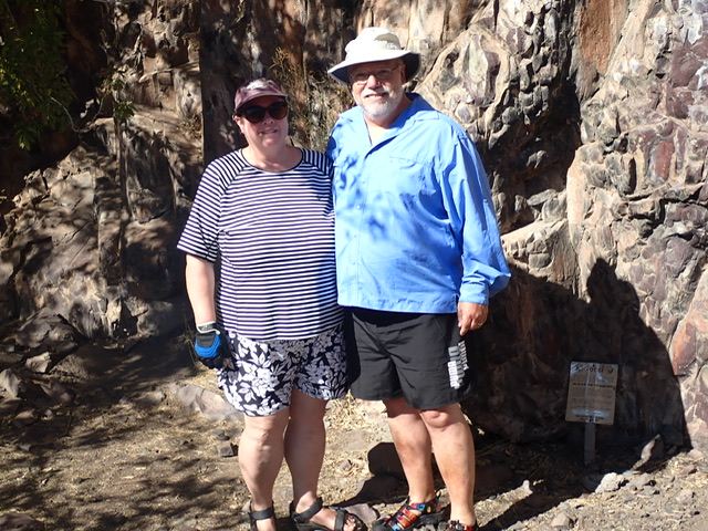
The drive from our home in Coloma, California to White Bird, Idaho, near the put-in, is a little over 11 hours, largely through desert terrain until you get to the mountain valleys of Idaho. We actually left directly from downtown Sacramento after an early morning doctor’s appointment, and decided to stop for the night at an hotel in Ontario, Oregon, about three hours short of our destination. That way we arrived refreshed the next morning at the campground and were able to take the whole afternoon to set up our rigs and our campsite at a leisurely pace. We also had to drop off a set of keys in White Bird at All River Shuttles, with whom we had contracted for $250 to shuttle our truck to the takeout in Washington state. While stopping for a snack in the General Store in Riggins, Idaho, I was surprised to see a slight young man working behind the counter with a long, unkempt beard as if he were a Quaker or something, until I saw the pistol in a holster strapped to his hip! I was reminded I wasn’t “in Kansas” anymore!
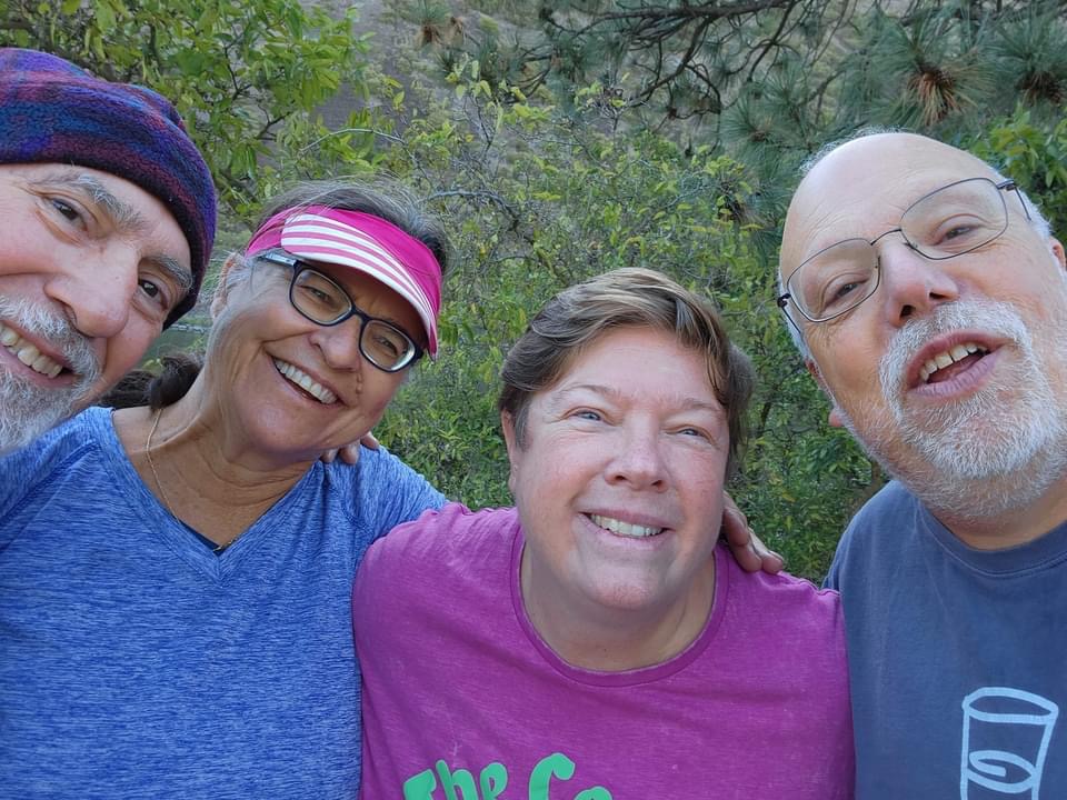
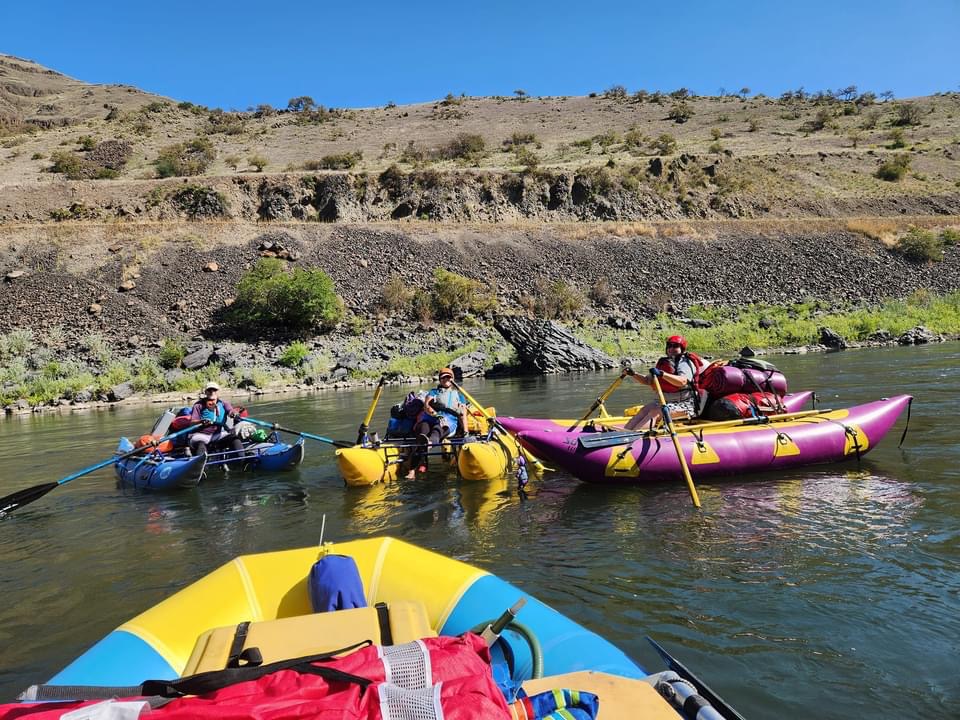
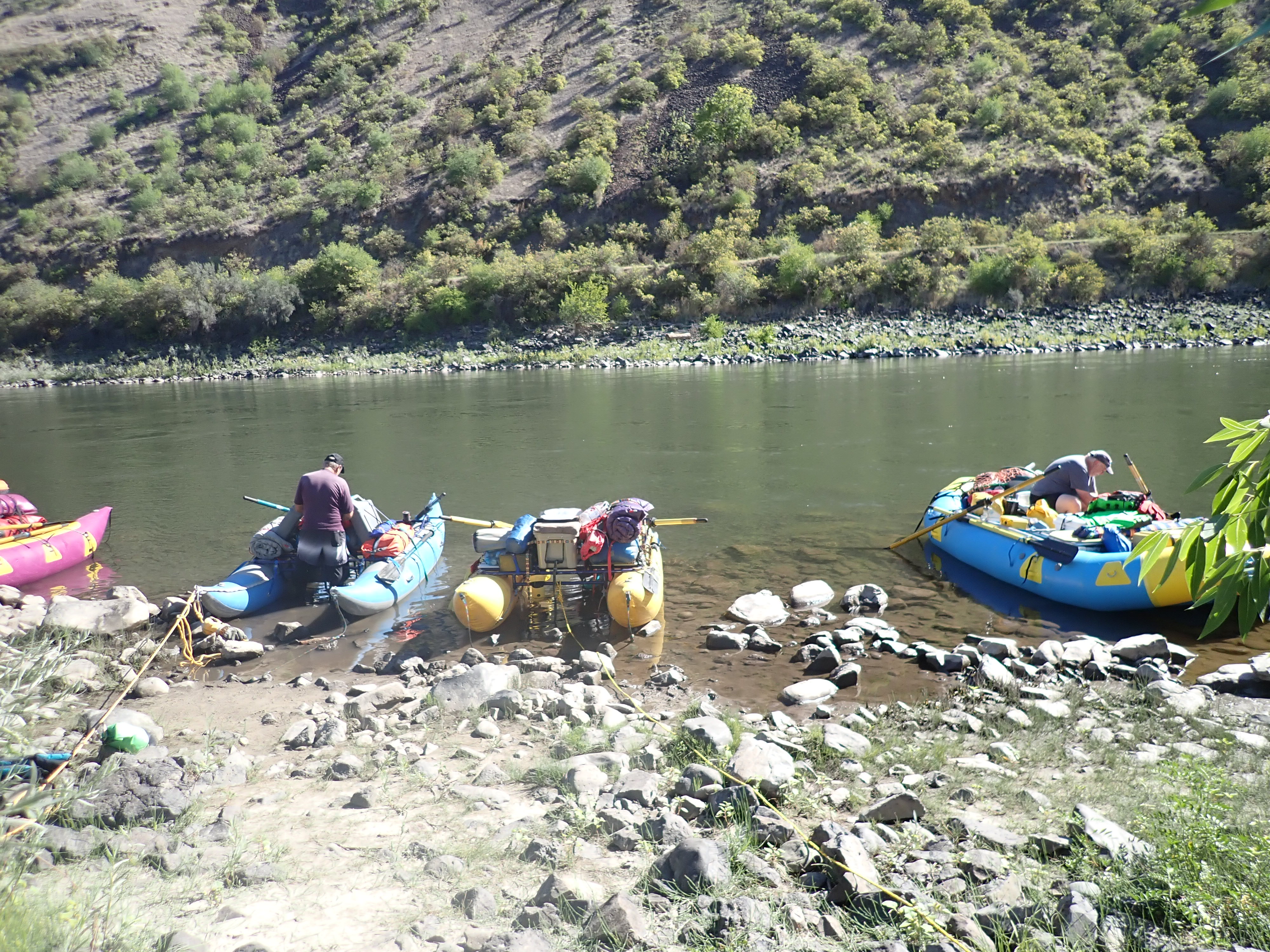
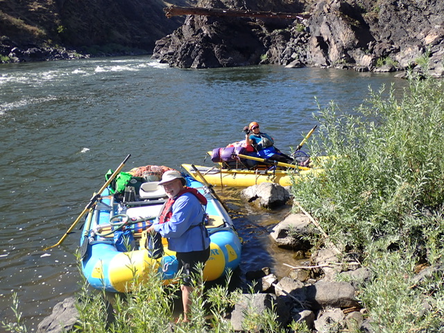
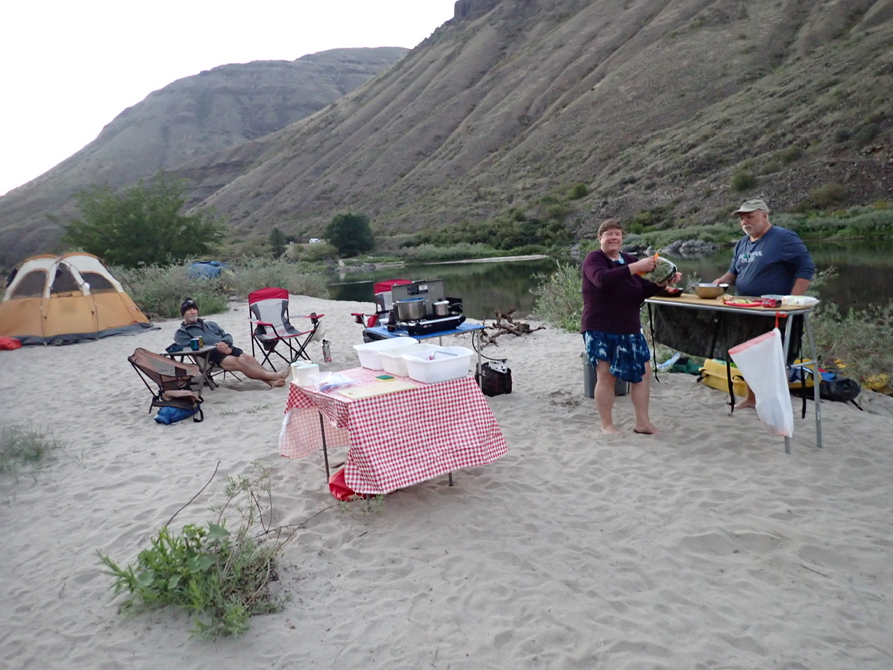
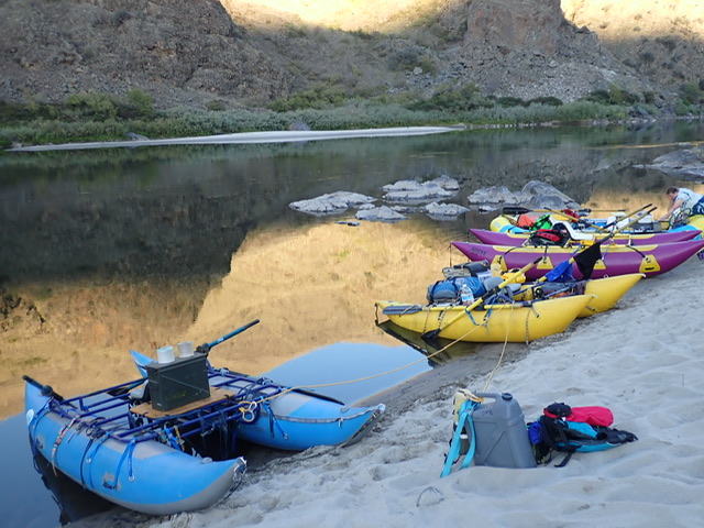
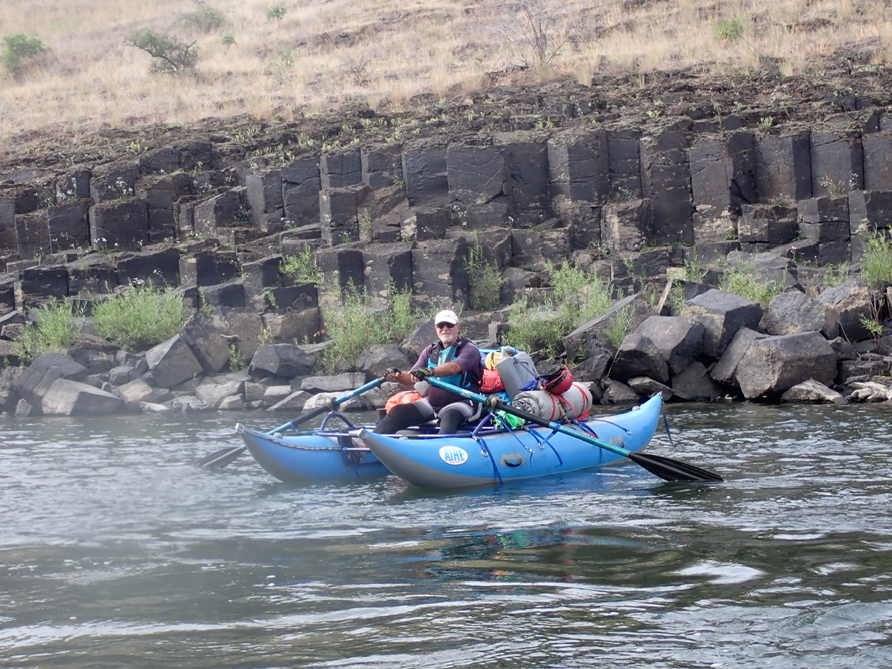
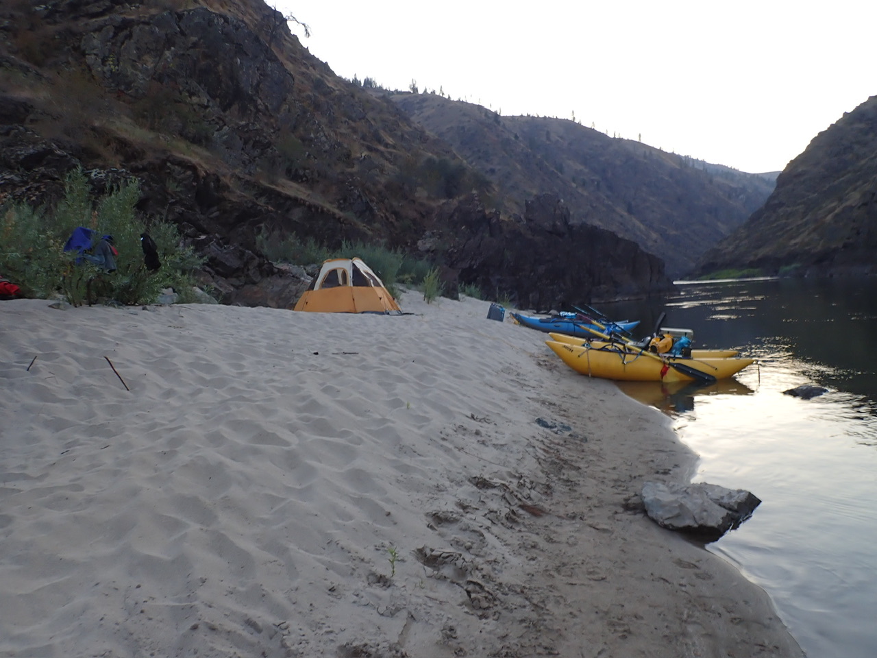
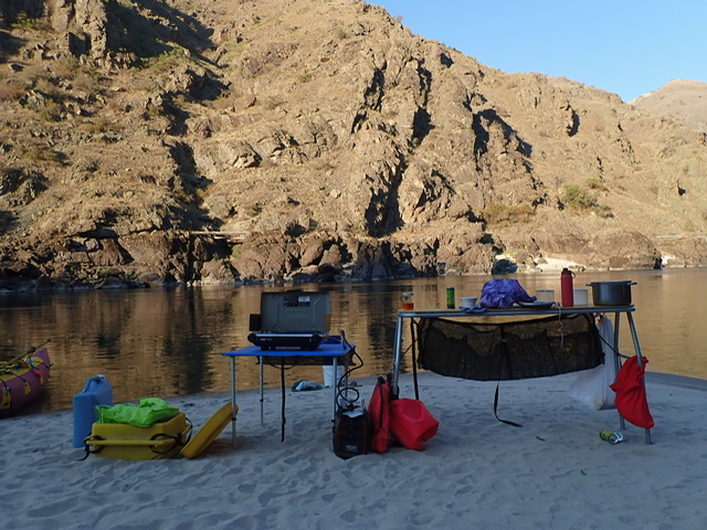
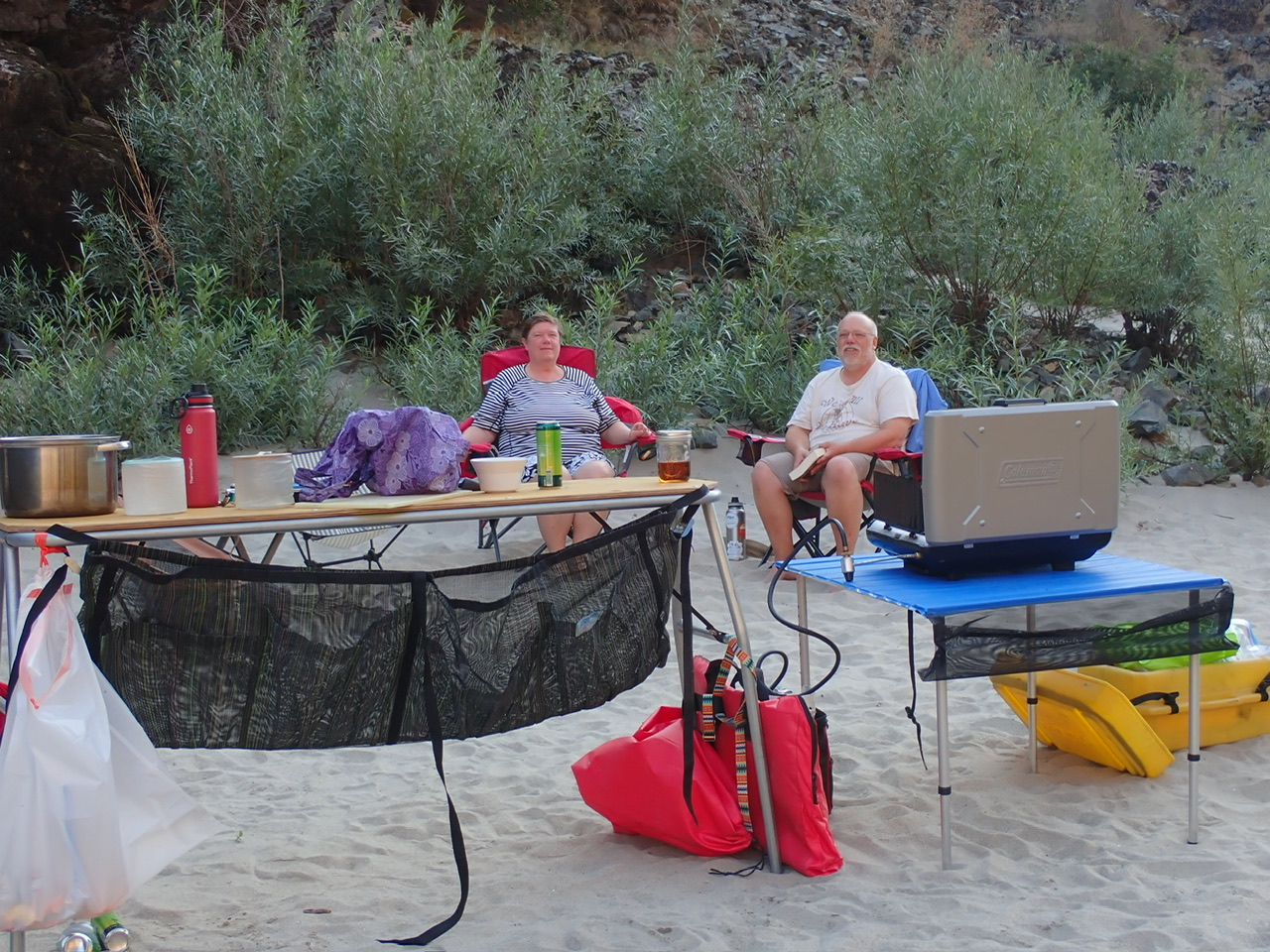
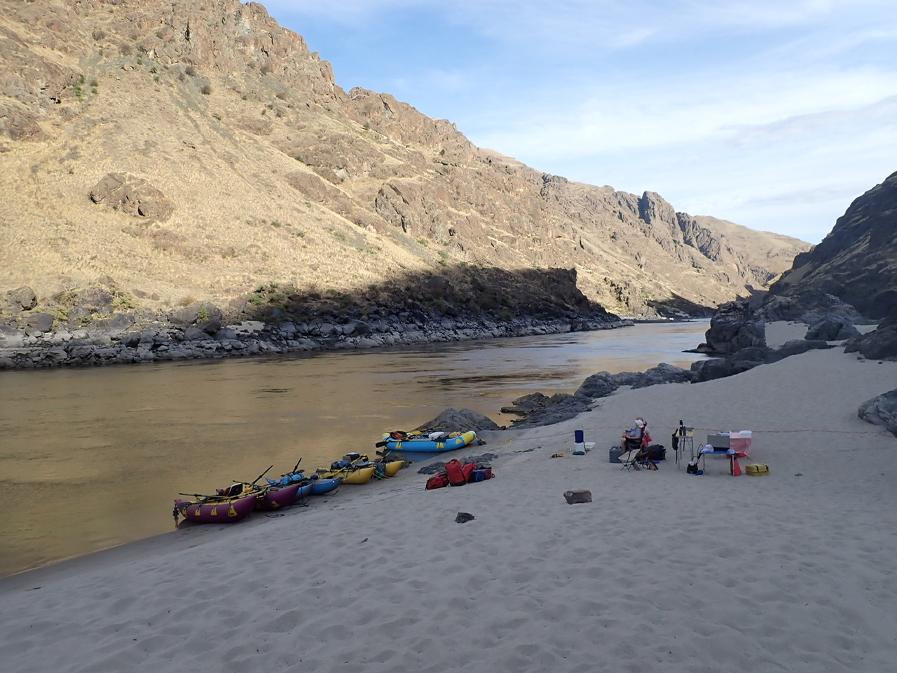
Our group consisted of Laura Zulliger on her 14 foot purple and yellow Sotar cat, Mark Johnson, Laura’s husband, on his 14 foot sky blue and yellow Sotar raft, Rick on his 13 foot, small tubed blue Aire cat, and me on my little 11 foot yellow Sotar cat. Laura and Mark carried the kitchen and wash buckets, a table, a large Engel cooler, a garbage dry bag and the “groover,” which is a toilet with a watertight container to haul out our human waste, while Rick and I carried another table, a small YETI cooler, the stove and a small propane fuel tank. Each couple carried our own drinking water, repair kit, first aid kit, camp chairs, tents, sleeping bags and pads, clothing, food, and beverages. We each made our own breakfasts and lunches, and then each couple made two dinners to share. Laura previously professionally guided this river back in the day, and Mark is a highly seasoned, class V boater who has also run this section of river multiple times, so we were in good company.
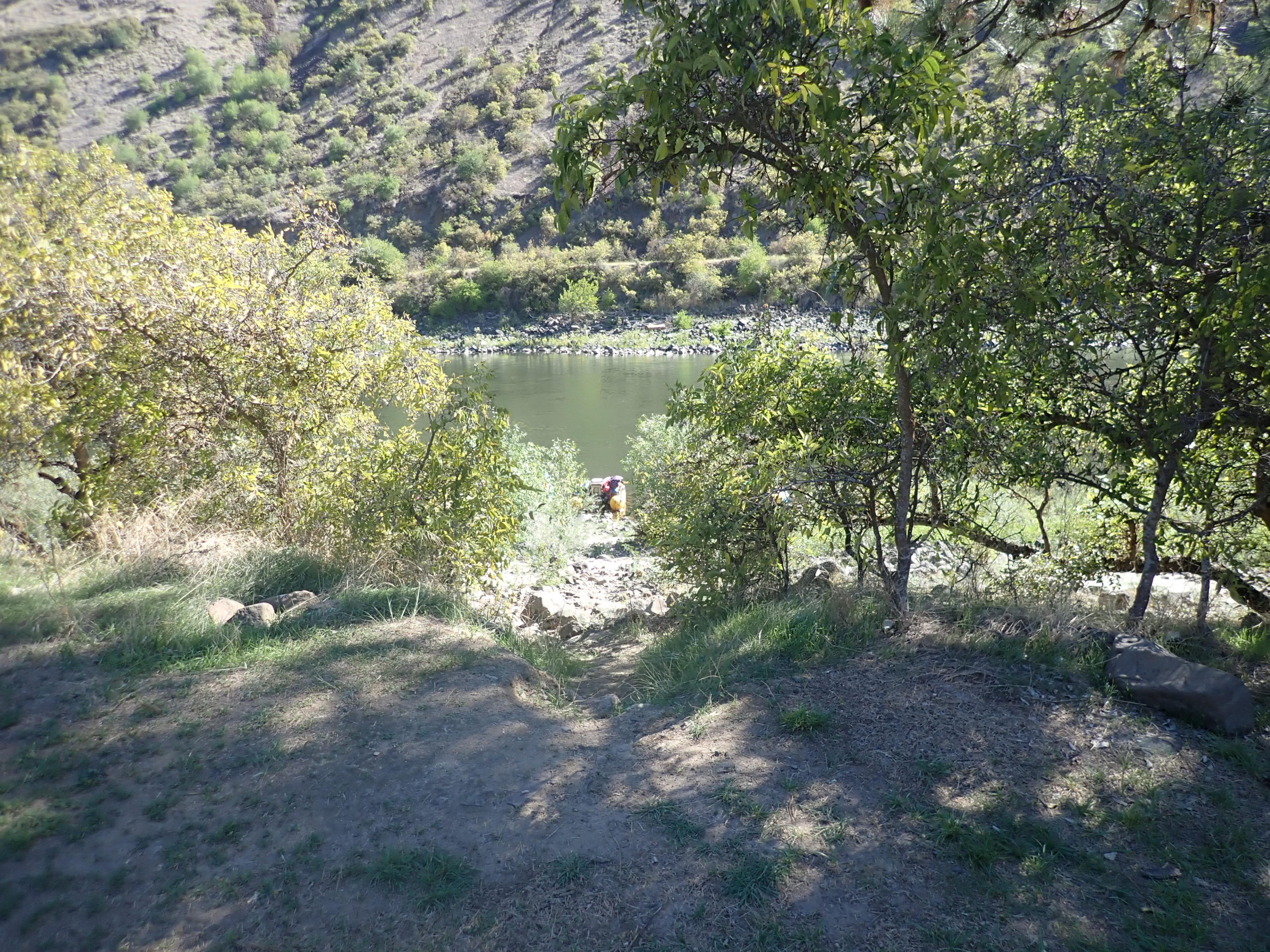
The Bureau of Land Management publishes a Boater Guide for the section of river from Vinegar Creek on the Salmon down to Heller Bar on the Snake River. The guide is inadequate for descriptions of rapids, but it is a good reference for finding where you are. It is 170 miles from Vinegar Creek to the Confluence with the Snake, and another 20 miles down the Snake before the first take out after the Confluence. We put in at Hammer Creek, allowing us 52.5 miles on The Lower Salmon plus the last 20 miles on the Snake.
In the Boater Guide, BLM explains that the 425-mile Salmon River is the “longest completely free flowing river in the lower 48 states,” and “has created the second deepest canyon in North America.” The Lower Salmon River is the only navigable section of the Salmon that does not require participation in a lottery to obtain a permit. You just go whenever you want, and complete a permit at the put-in.
Hammer Creek is at about mile 52.5 (the mile count diminishes as you go down river, so that the downstream confluence with the Snake River is at mile zero). The flow was 4600 cfs (cubic feet per second), diminishing about 200 cfs per day. The recommended flows are between 3,000 and 10,000 cfs (one rapid downstream becomes highly dangerous above 10,000 cfs.) So we were floating the river on the low side, but it still felt like big water at times, and it was definitely higher than when we did it in 2020, with some rapids opening up to more routes and others becoming more pushy.
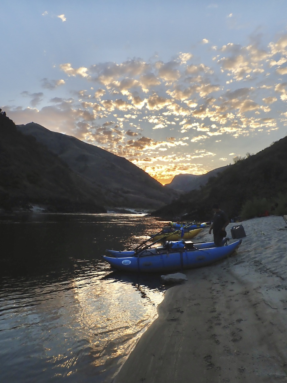
Hammer Creek is a great put-in. It has a campground with potable running water and flush toilets for only $5/night with a National Parks Senior Pass, $10 otherwise. If you are lucky and get to the campground early, you can get a campsite with river access so that once you load your boats at the ramp, you can float them down next to your campsite overnight. The ramp has secure boat tie-offs and cement prep sites on either side of the ramp. We didn’t have cellular reception there but our friends did. Each boat needs to purchase an Idaho Invasive Species Sticker and a Washington State Discover Pass (for takeout) before you leave. A self-issue permit at the put-in is required for each group.
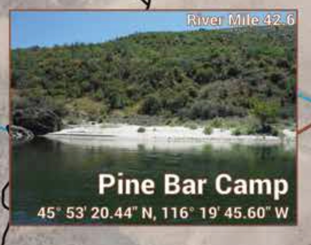
Day One: Hammer Creek (mile 52.5) to Pine Bar Camp (mile 42.5)
Laura and Mark didn’t arrive at the campground the day before put-in until late, so the next morning there was still some loading to do and we did not put on the river until around noon. As a result, we chose to go a little less distance that day.
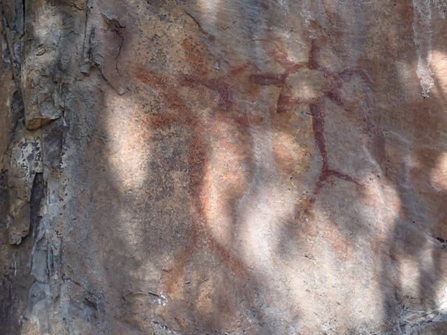
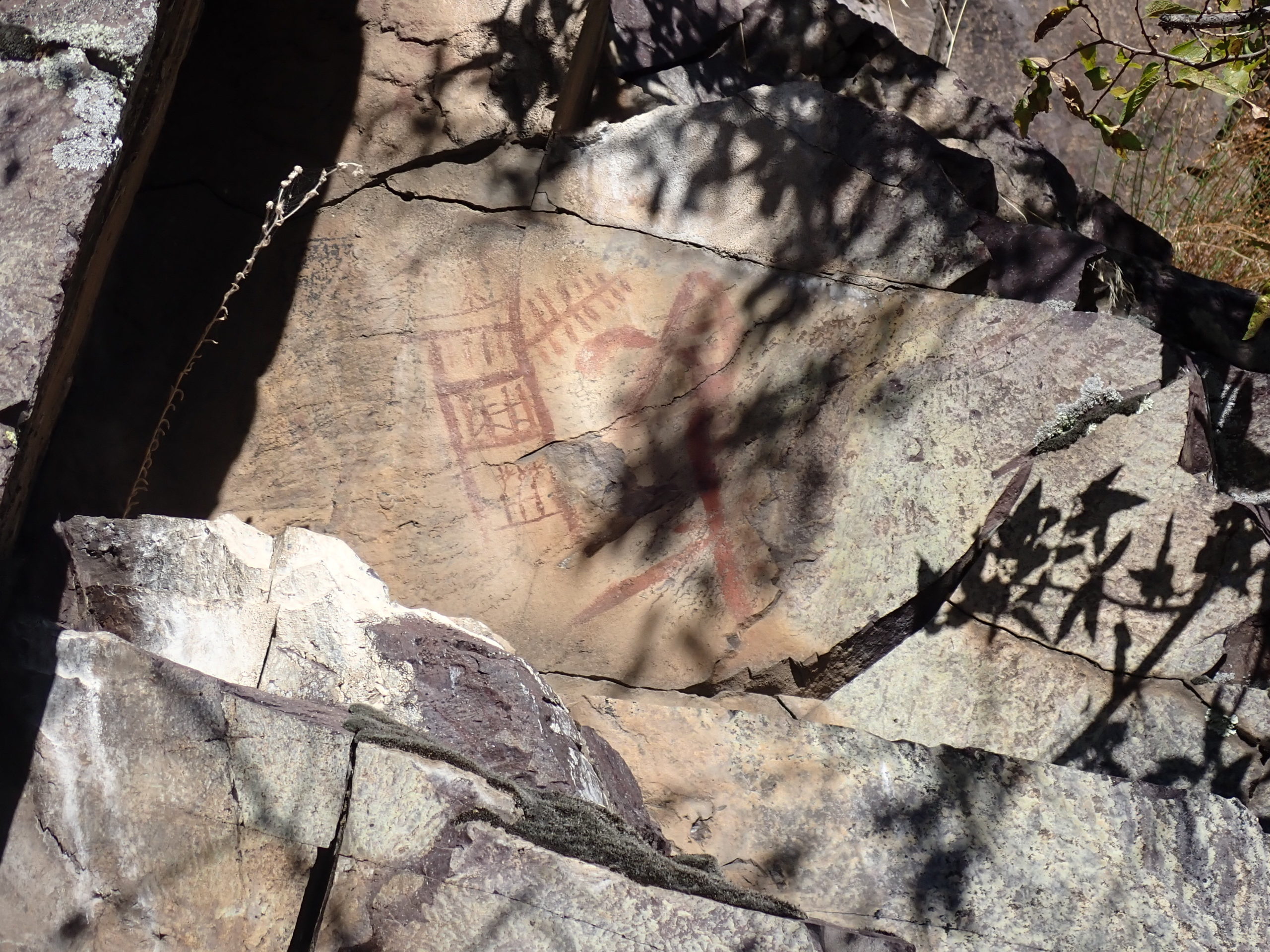
The river starts out right away with a fun, bouncy wave train, with Class II rapids and riffles keeping the water moving. At about mile 45.5, we stopped to look at the pictographs on river right up a short but steep, rocky path. Pictographs are designs painted on the surface of rocks. According to the Boater Guide, “the function of pictographs is unknown. They may have been drawn to represent events, serve as trail markers, or send messages to others. Along the Lower Salmon River, the pictographs are usually red. The paint was made by grinding Ochoa, or iron oxide, and mixing it with oil or grease and resin.” It is not known exactly when these pictographs were painted, but the first human inhabitants of the Lower Salmon River canyon were Native Americans who lived in the canyon over 12,000 years ago. In more recent centuries, the Nez Perce Indians dominated the canyon. Observers of pictographs up river in the Main Salmon area noted that horses were included in the pictures, thus dating them to the time after the Nez Perce Indians were introduced to horses in the early 1700’s.
Just after the pictographs, we entered the first canyon, called Green Canyon. I am not sure which rapid in this canyon it was, but I was in the lead and decided to hold back because the entrance to a left hand turn was blind and I didn’t know if there was something there I should be warned about. Having done this river so many times with the confidence that there was nothing to worry about, Laura headed down the inside of the rapid, while Mark and Rick went to the outside of the turn. I stayed inside too. It was a bit bumpy on the left but not too pushy. On the other hand, Rick and Mark met some unseen turbulence at the bottom right – Mark’s right oar popped out of his oarlock and Rick’s right tube got swallowed. The river took Rick’s coffee cup and cup holder too! Fortunately, we later found it floating downstream, the cup still in the cup holder. The guide doesn’t say anything about a scouting point for any of the rapids in this section, but had there been one, it might have been worth scouting.
As we approached Pine Bar, which is another put-in location, there seemed to be some commotion from the group ahead of us on Pine Bar Rapid, so we stopped to take a look. They had wrapped a raft on a large rock in the center of the river towards the bottom of the rapid, and some IK’s were in the eddy below trying to free the raft. We considered running the river past them but we didn’t want them to think we were abandoning them and we didn’t want to get in their way, so we waited. Finally, they freed their raft. We were already out of our boats on a nice beach. Since the put-in just below the rapid might result in crowded campsites ahead, we decided to camp for the night at Pine Bar Camp, and run the rapid the next morning.
It was Laura and Mark’s night to cook that first night, and they made a tasty and abundant salmon dinner. We were all just so happy to be out in the wilderness again, with no cell phones nor internet, and no sounds but those of the river and the wildlife. We were to discover that for the entire trip, there was no moon and there were no clouds in the sky, so we got a clear view every night of the Milky Way, the Big Dipper, Orion’s Belt, Cassiopeia – all the usual suspects. We were super lucky with the weather – fall hadn’t really set in yet, so we didn’t need layers on the river, but the mornings were refreshingly cool until the sun shone. We only had one slight little drizzle one day.
Day Two: Pine Bar Camp (42.5) to just below Lower Whitehouse (27.5)
It turned out that the run down Pine Bar Rapid was quite straightforward, and the tongue didn’t go anywhere near the rock where the other group got pinned, so we weren’t sure how they even got there unless they chose a line less travelled! There are roads that parallel the river intermittently throughout this run, some of which are for off-road vehicle only, so for a while on this day, we saw non-boaters on the shore occasionally. But at about mile 36, the road ended, and there weren’t any more roads accessing the river for the next 24 miles. At mile 33, we entered Cougar Canyon, which is a steep, narrow, 5-mile long canyon with few camp spots. On a river like this, where rowing in slow moving water can become tiresome, we really looked forward to the canyons, which offered more dramatic scenery, shade and faster moving water due to the constrictions. There were lots of Class II and some Class III rapids during this stretch.
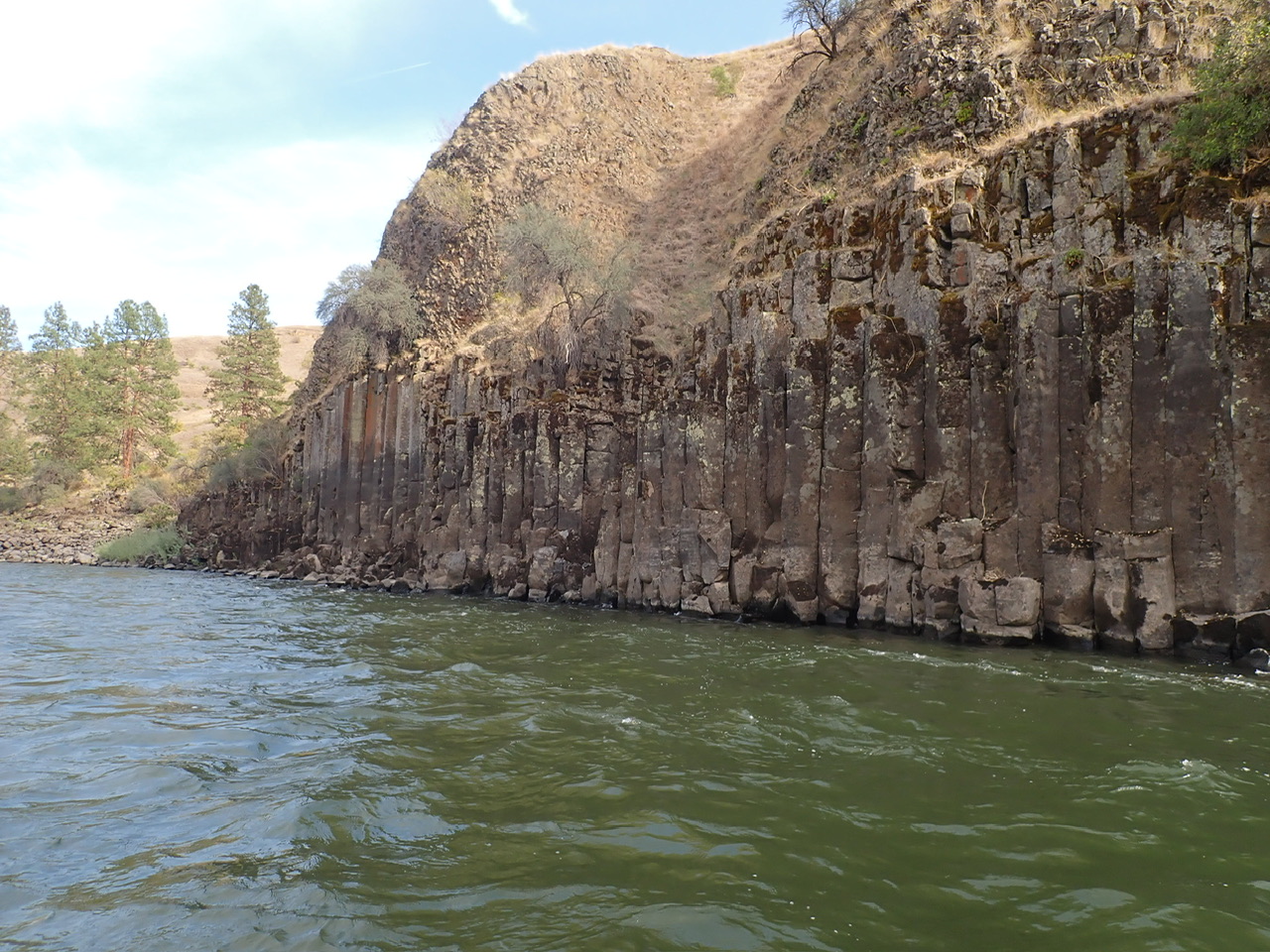
This is also when we began seeing basalt columns, which fascinate me. Apparently, and I will have to ask a chemist or geologist why, lava flows cool into square columns. The longer they take to cool, the bigger the columns are. Just below the surface in all the mountains surrounding us were these basalt columns. I only wished I could take some home to build the rock wall we are making! They would fit so well together!
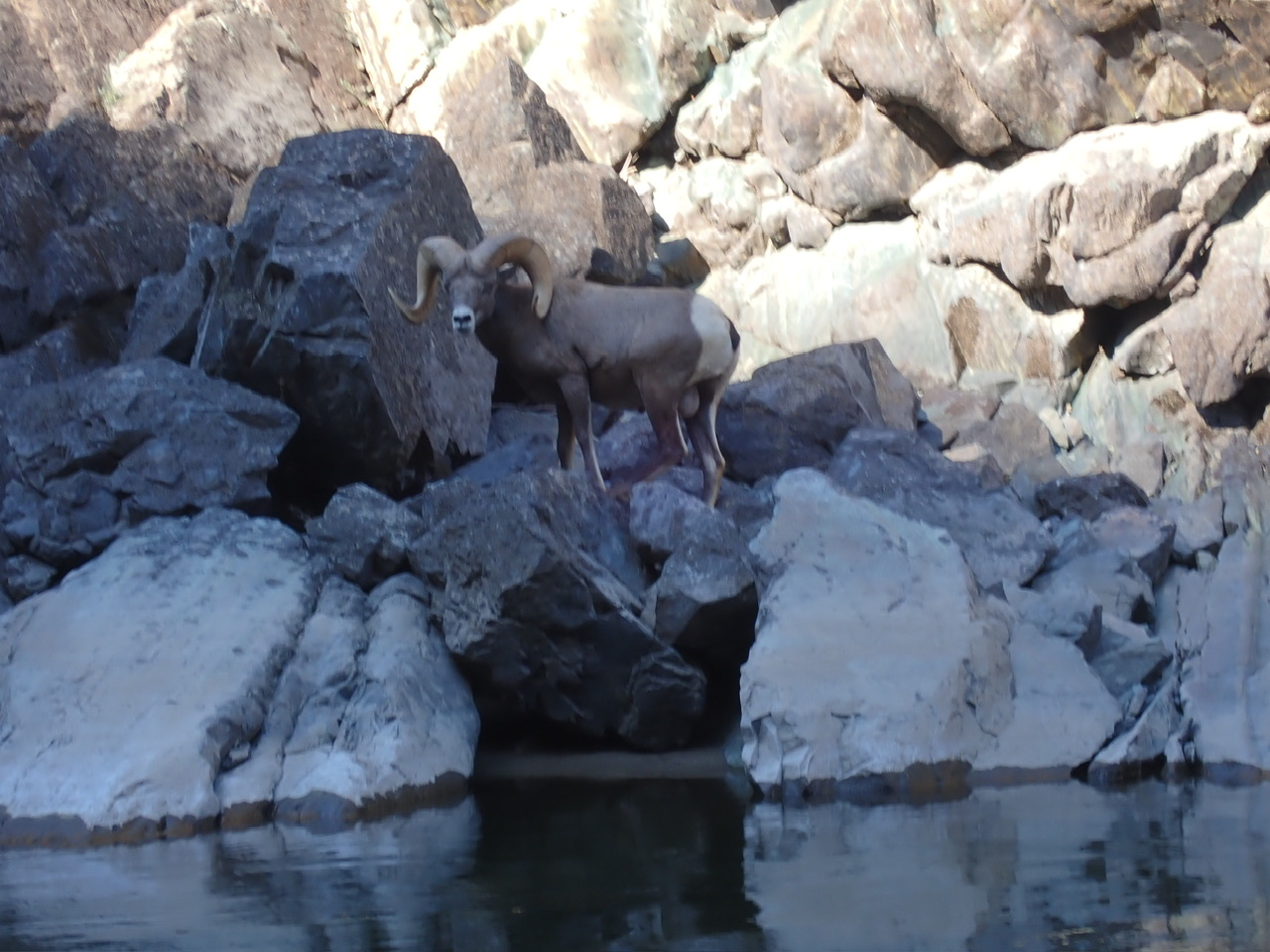
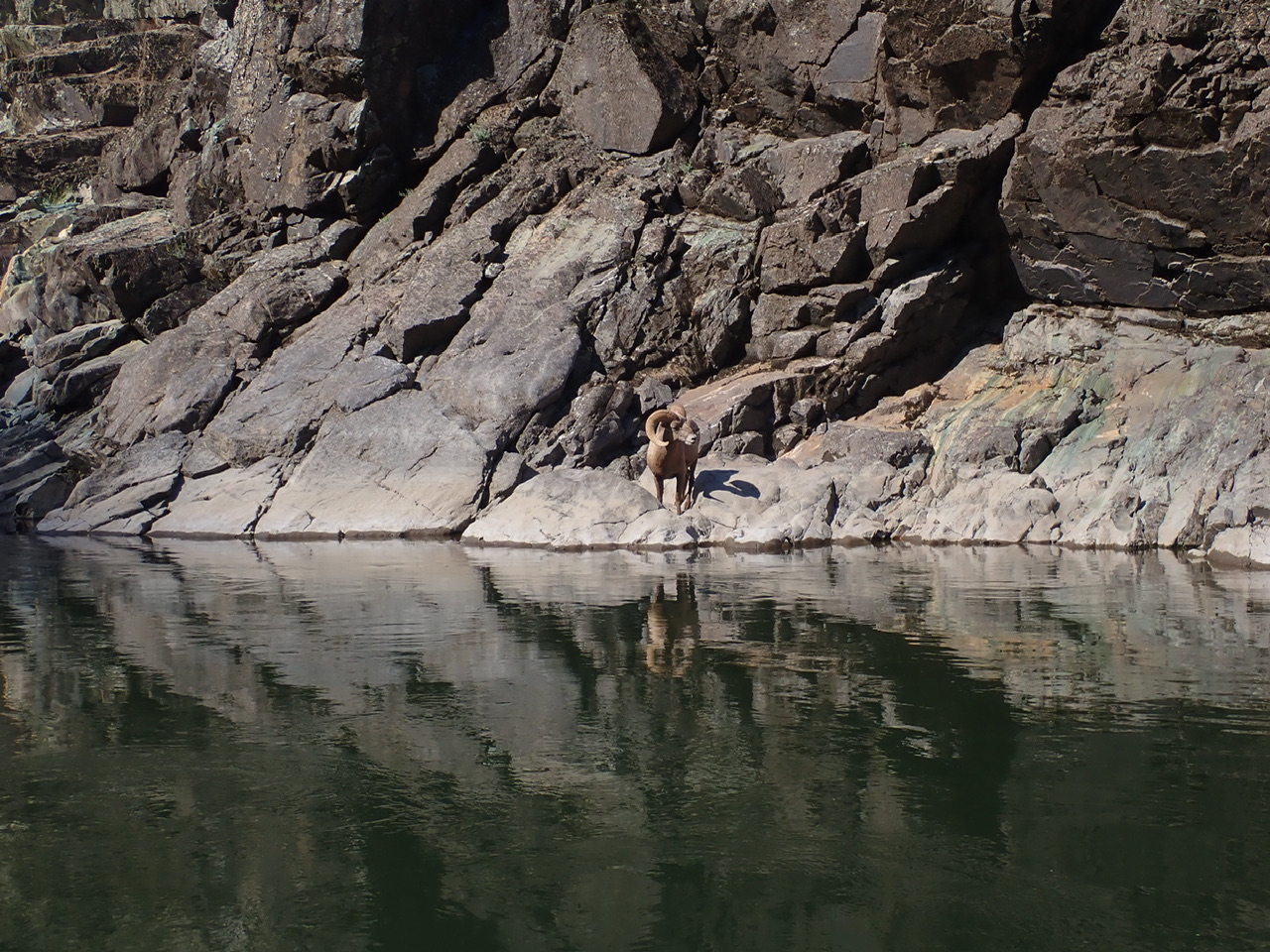
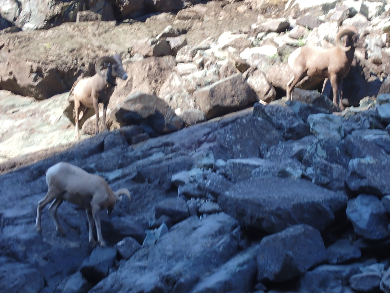
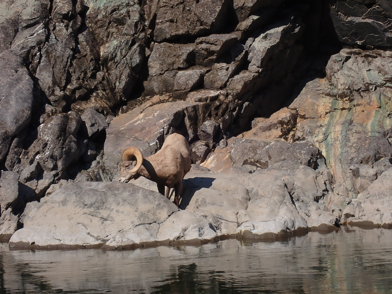
We were also treated to the sight of a family of big horn sheep at close range. They looked gentle enough but I was glad there was water between us and them – those horns look pretty darn powerful.
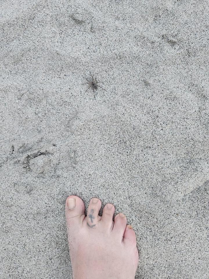
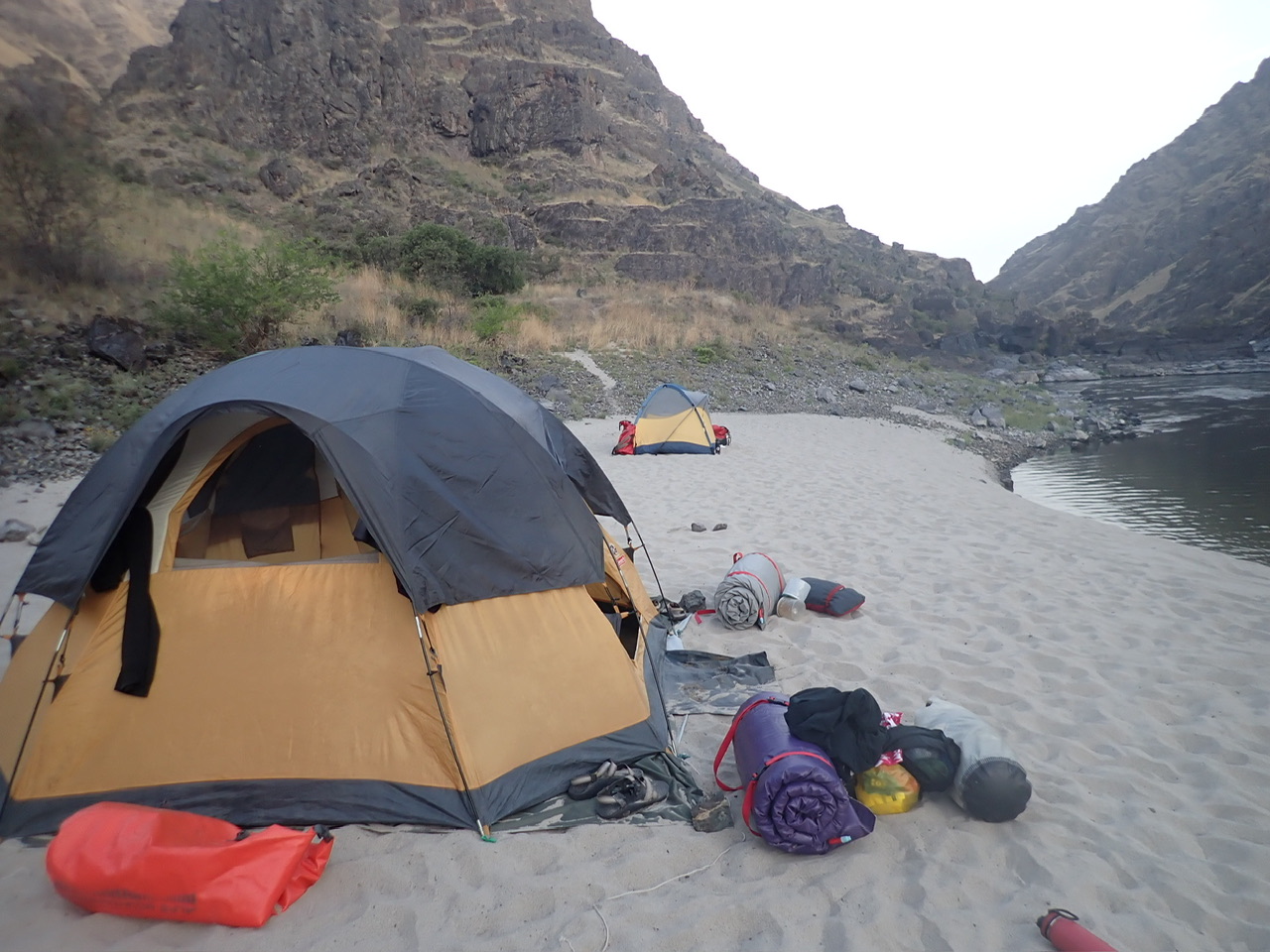
At the end of the canyon, we camped at an unnamed beach on river left just below Lower Whitehouse Camp. Well, actually, Laura did give a name to this the previously unnamed beach: Spider Bar! Laura was quite taken aback by the several, very large spiders we saw in the sand there, but I didn’t really notice them and they didn’t bother me – I just chose to wear flip flops when I otherwise might have gone barefoot in the soft sand, and I made sure we zipped up our tent completely at every turn.
There was only one really good flat tent spot on the dry sand, and Mark and Laura kindly gave that to us because we had the bigger tent. Mark carved out the sandy hillside a little with an oar blade to flatten another section for their tent.
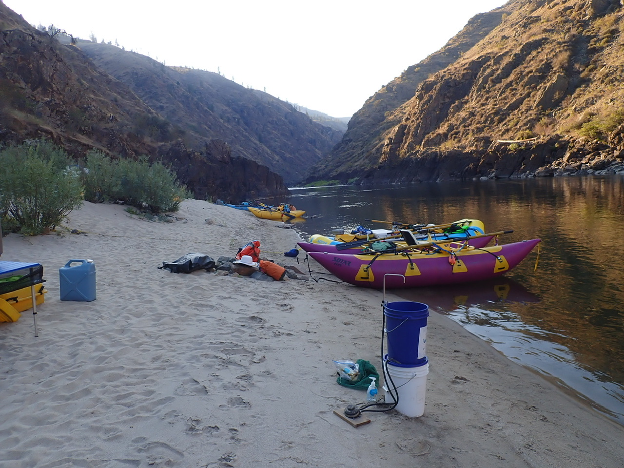
A large group of young partying rafters were camped just upstream at Upper Whitehouse but fortunately, we didn’t hear them at all. Having again picked a camp on river left guaranteed early shade because the sun set behind the mountain on our side, and conversely in the morning, the sunshine on our camp helped to get us up and out of our tents early, a goal which was particularly challenging for Laura!
Rick and I made chicken tacos with Spanish rice and black beans, much of whose ingredients did not require refrigeration. We learned quite a bit about minimizing the need for refrigeration on our sailboat, and have extended that knowledge to our wilderness adventures. We used canned chicken, which tastes just fine if cooked in taco seasoning, as well as canned tomatoes, canned salsa, canned black olives, canned black beans, etc. (Cans are far better than glass on a river for many reasons, the most obvious of which is that all of our boats are inflatable!) The only ingredients I splurged on for this dinner that required refrigeration were some sour cream and cheddar cheese. And even the cheddar cheese doesn’t absolutely require refrigeration. Laura and Mark are sensitive to gluten, so we were lucky to have packed some corn taco shells, an item I added at the last minute.
Day 3: Below Lower Whitehouse (27.5) to Eagle (12.8)
Just after leaving our campsite, we entered into yet another canyon called Snowhole Canyon, which continued for 10 miles. Snowhole Rapid is at about Mile 23.5, and is rated as a Class IV. We scouted it but we all made it through without incident. When we floated this river with Laura and Mark’s family in 2020, it was important to scout this rapid because there were some fairly technical, must make moves, starting from river right, then ferrying over using the backwash from a pour over to river left next to the large boulder about a third of the way down, then maneuvering your way down from there. This time, the flow was greater and there was pretty much a straight shot starting down river right and moving to center. We watched some other rafters navigate it and decided it was quite doable.
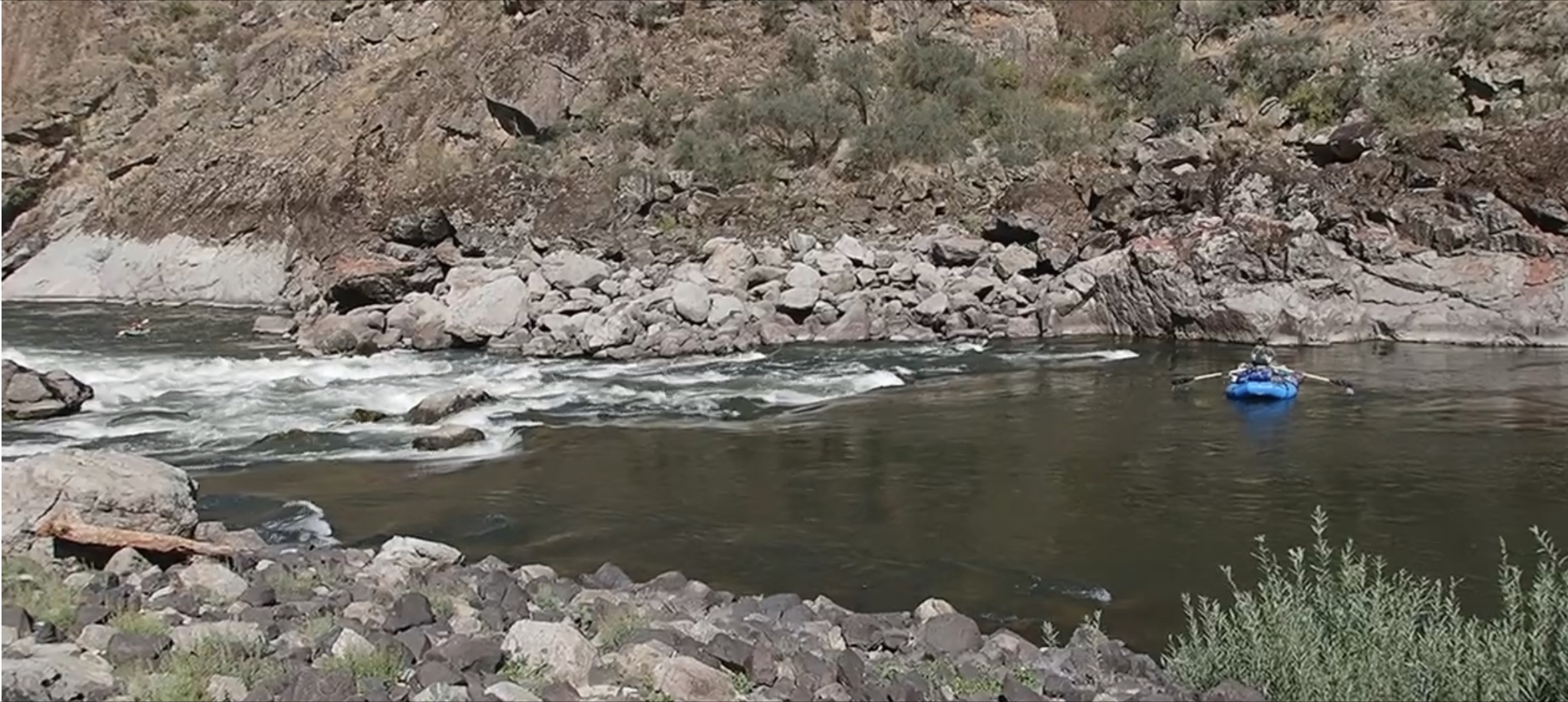
There are plenty of rapids in those first 10 miles that make for a fast and fun morning. However, a rapid called China put an end to my frolicking for the day. It is rated as a Class IV and it is blind, meaning you can’t see the whole rapid from the start because it makes a big left turn around a bend. I hate blind turns! And it is long. The boater guide recommended we scout but we didn’t. I was last to come around the bend and found myself in some very pushy water heading for the middle of the rapid where there was a steep pour over occupying the middle third of the rapid. I had only a split second to choose whether to go right or left of the pour over and I made the wrong choice. I saw out of the corner of my eye that Rick and Laura had gone right, so even though left seemed more attainable from my position, I thought perhaps there was something down there I should avoid so I pulled hard right, probably after hesitating a second too long. Meanwhile, I didn’t see Rick below the rapid, pointing me left! I pulled away from the pour over as hard as I could but there was no stopping the pushy water – as I went over the side of the pour over, my boat stood on its bow and before I could register what was happening, I was catapulted out of my seat and into the turbulent whitewater in the hole below the pour over. I think I did a summersault under water, I had momentary contact with a few rocks and my boat, and I was spit out into deep water. When I turned around and saw my boat upright, I was really surprised – I was convinced it had flipped over and then righted itself again, because I couldn’t imagine it not flipping when it threw me out. But no, they said, my boat never flipped, thank goodness. It would have been a much bigger deal if we had had to right my boat with all my gear on it.
This was the very first time in the nearly 15 years or so of owning my cat that I came completely out of it. Fortunately, nothing was bruised but my ego. But my confidence was shaken. Also, I couldn’t get back into my cat by myself – that was a revelation. I used to be able to, but as I told Laura before this trip began, I choose not to do rivers anymore where I could come out of my boat because I just wasn’t sure I had the strength anymore to get back on by myself. But obviously, there is no way to guarantee you are not going to come out of your boat unless you stop boating altogether. So I have decided at my next opportunity, I will brave the cold water and explore options for getting back on my boat should I fall out, even if it means I use a strap or something to step up onto it.
Anyway, that mishap made for a not so pleasant afternoon for me. After Snowhole Canyon ended, there were a few Class II rapids but mostly a slow slog to our next campsite, and I was ready to call it a day well before we had made the distance.
We camped at Eagle on river right, but by now the river had changed direction somewhat so the sun still set early over the beach, providing us some shade. A road built for off-road vehicles came down to the river there, so we had to contend with a few hunters and anglers. They were mostly respectful of our space and didn’t stay the night, but Laura was pretty shook up by their gunshots.
It was Laura and Mark’s night to cook dinner again so they heated up a chicken dinner she had prepared before the river trip began – a good way to make an easy meal.
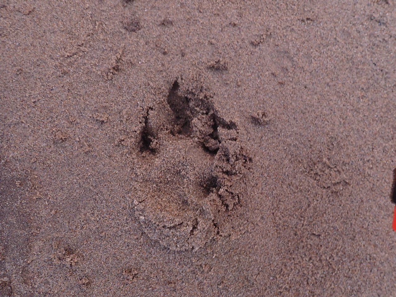
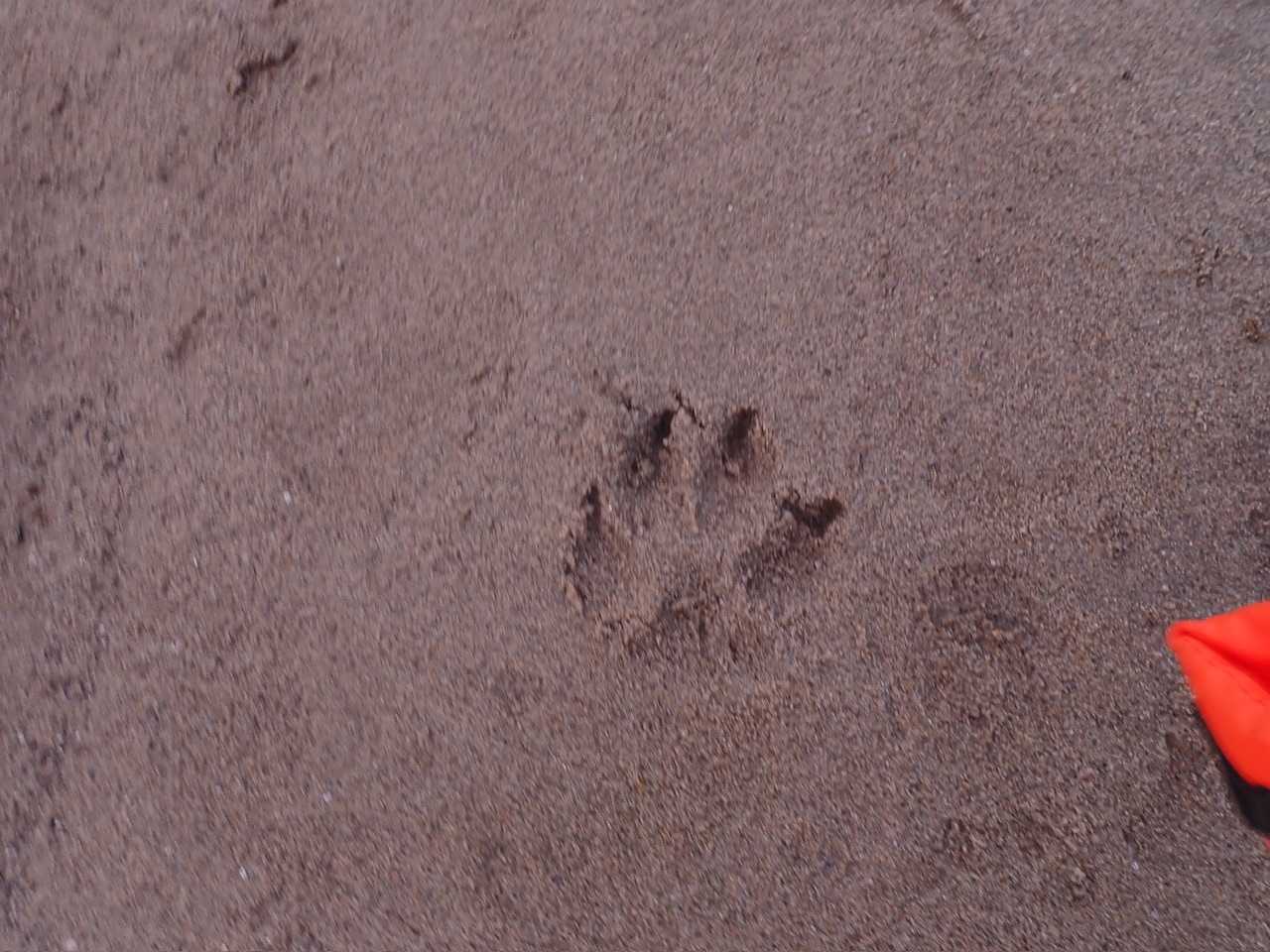
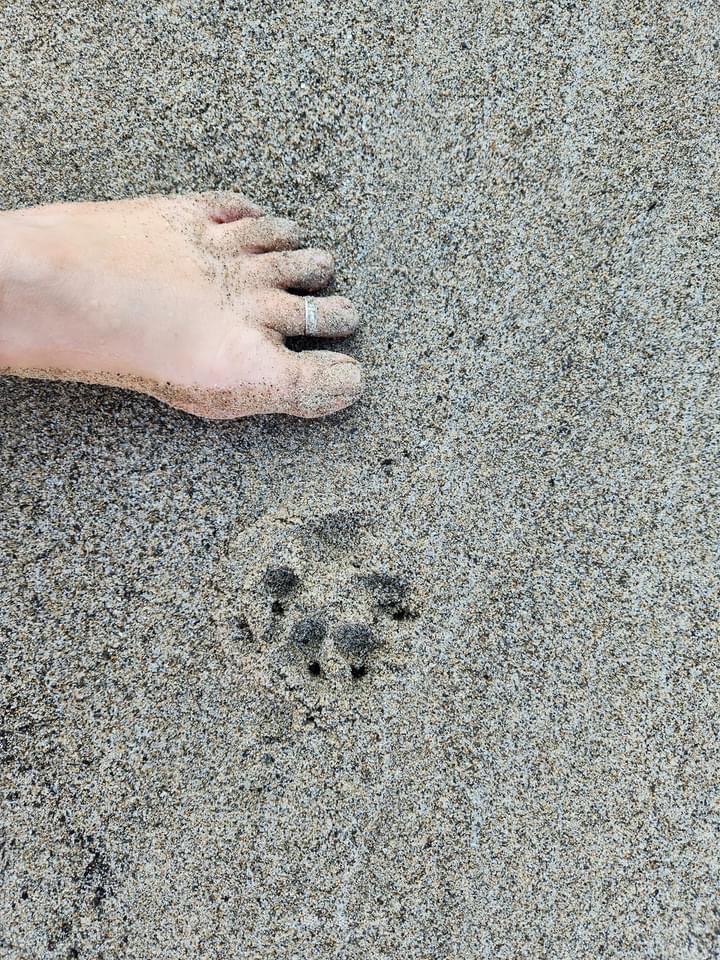
Also, for the second night in a row, we found paw prints in the sand that hadn’t been there before we went to bed. Any ideas? My guess is wolf.
Day 4: Eagle (12.8) to Lower Geneva Beach on the Snake (184.1)
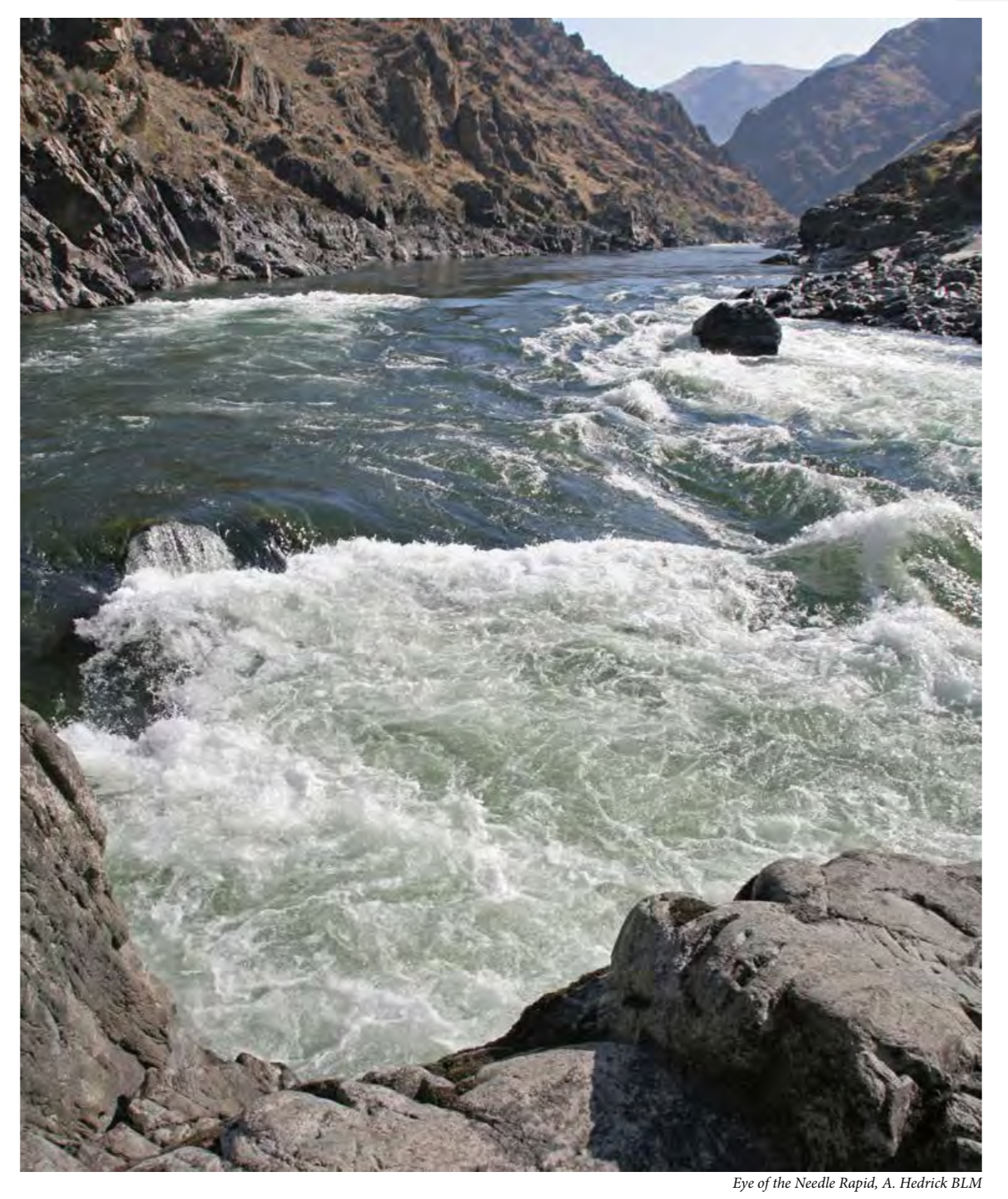
This was a fun day. The water moved fairly consistently all day long and there were a good number of fun rapids, although my hesitancy from my swim the day before made me enjoy them a little less than I would have otherwise. At Mile 5 begins the Blue Canyon, which I think is the prettiest canyon on this run. At about mile 4, Slide Rapid appears as nothing more than a riffle, although apparently, above 10,000 it becomes Class V and at over 20,000, Class VI (unrunnable). The last rapid in Blue Canyon is called Eye of the Needle, named for a constriction at the bottom. The entrance to the rapid was a little intimidating but once you saw “the eye,” you realized the width of the constriction was much larger than the name would suggest, and it was easy not to miss it.
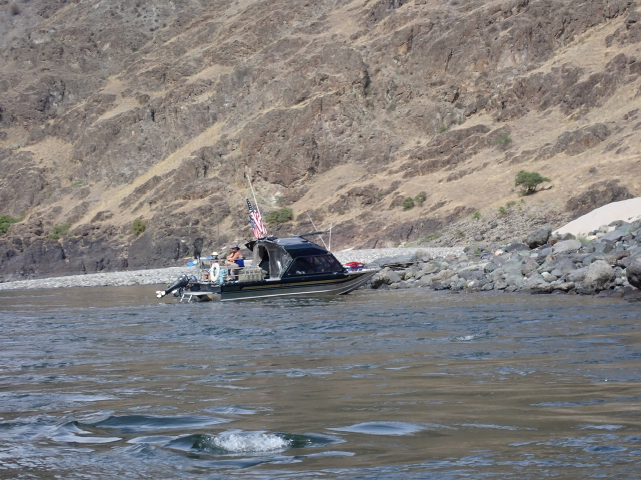
After 12.8 miles, we came to the confluence with the Snake River. This wide, large volume, dam-controlled river is open to jet boats and has some small, off-the-grid housing developments scattered along the shoreline, mostly accessible only by boat. After a few ripples at the confluence due to turbulence of two rivers intersecting, the next several miles after the confluence are referred to as “Snake Lake” because the water is moving so slowly. If you run the lower Salmon, there really is no good takeout except to travel 20 miles down the Snake River to Heller Bar, so you are stuck with it. As mentioned earlier, there are ways to make this slog less painful: some hire a jet boat to take them and their gear to the takeout, and others bring along a small motor to caravan their boats out, pulled by the boat that has the motor attached to it.
You have to listen for jet boats and give them room to travel past you, especially in the few rapids that exist, letting them have the deeper water. In exchange, they are supposed to slow down when they pass you so as not to make a wake. They did that about half the time. I was unfortunately afloat next to a beach trying to put wet socks on my wet feet and then sandals over my wet socks when a jet boat came barreling by, full bore. By the time his wake got to the shore, the waves had turned into mountains, breaking on me and soaking me head to toe, almost flipping my cat. Needless to say, I didn’t appreciate that. The weather had started to turn cooler. I did not want to be wet! The good news is that none of the jet boats we saw this time were flying Trump flags; the last time we visited this river in 2020, they were everywhere. We saw a few Trump flags on houses on shore, but it was nothing compared to 2020.
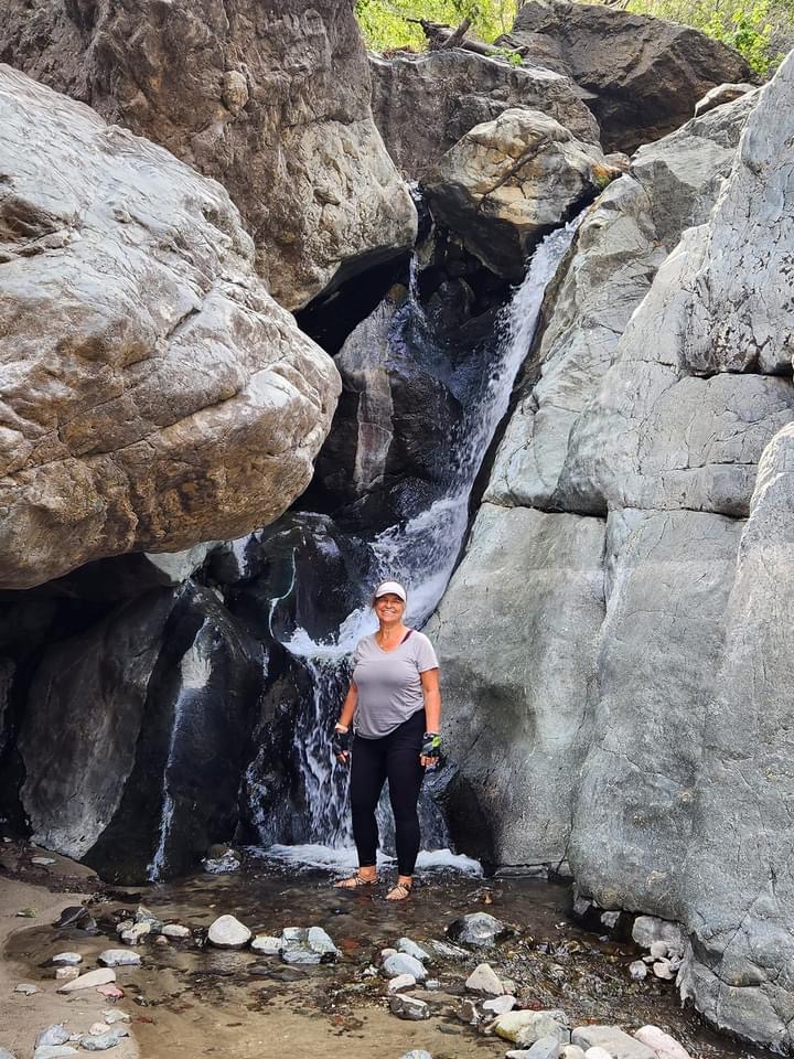
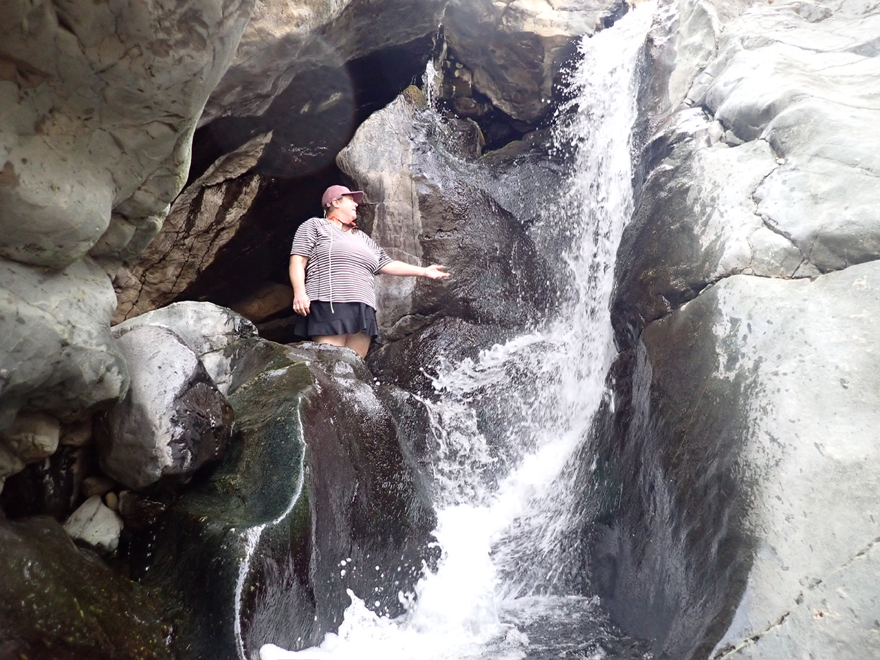
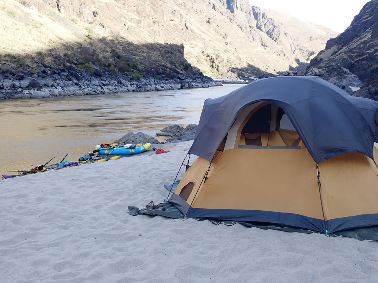
The confluence with the Salmon River is at about Mile 188 of the Snake River. Again, the mile numbers diminish as you go downstream (please tell me, what sense is there to that? The numbering system obviously was concocted by someone in a motorboat going upstream, not at all in tune with the natural flow of things, namely, that rivers only flow one way, and that is downstream!) Anyway, only a short two miles down from the confluence is a nice little stop called Cherry Creek, with a waterfall you can walk around. Just past that is a series of three beaches called Geneva; we camped in the last one.
Once the daytime jet boat traffic subsided, our beach on the Snake was quite peaceful. However, since this river is dam-controlled, the flow can vary significantly throughout a 24 hour period. We double tied all the boats to both a rock and to a sand stake (don’t forget a sand stake if you do this river), and it was a good thing we did. When I woke up the next morning, my boat was afloat and the sand below our kitchen area was wet; we were lucky nothing on the ground in our kitchen had floated away, including our chairs. Fortunately, our tents were both up high on the sand bar. Mark and Laura had gotten up several times during the night to pull the boats up on shore.
Rick and I made a dinner that night that I concocted without a recipe (a rare thing for me) when we were sailing; it is a recipe that requires nothing refrigerated except maybe feta cheese. And like I said, there are ways to keep cheeses fresh without refrigeration. So I would make this dinner while sailing when we were out of fresh foods, but it turns out to be quite useful for river trips as well, especially for the last night when ice in the coolers has diminished. It consists of short curly pasta, pesto, Kalamata olives, canned chicken, sun dried tomatoes in olive oil, and feta pieces garnished on top. The only thing bad about the ingredients is that some of them can only be bought in glass jars. I pack each glass jar in a sock inside an impenetrable dry box (we used an ammo can) so if one breaks, the broken glass doesn’t become a problem. I like to serve crackers and Trader Joe’s canned dolmas as an appetizer. I think the dinner was again a big hit. And we had some left for lunch the next day, to substitute for our tortilla-wrapped tuna salad that Rick made fresh every morning, which was getting pretty tiresome by then.
Day 5: Lower Geneva Beach (184.1) to the takeout at Heller Bar (168.5)
I wasn’t looking forward to these last 16 miles of mostly flat water. The guidebook says there are a few rapids but they are just some big wave trains that you can cheat if you want, and I was so tired and my arthritic hands hurt so much from the oar gripping that I cheated where I could. It is now two weeks later as I write this and my hands still hurt. But mostly the water was so flat that you are constantly searching for the bubble line that may indicate some modicum of current. The only trouble with that is that it is hard to read the water for current when you are facing up river so that you can pull versus push your oars, and pushing wasn’t getting me anywhere.
The USFS Cache Creek Ranch is at mile 177, and Rick and I were hoping to stop there for use of the facilities and maybe to eat lunch. There is a nice dock with lines already tied to the cleats to tie off your boat. Unfortunately, a sign says that inflatables are not allowed on the dock, and that we were instead supposed to use the nearby, non-existent beach. We each took turns running up to the bathroom to do our business and then joined Laura and Mark at a beach across the river for lunch.
The only thing redeeming about this day was that I anticipated it to be so long that I was pleasantly surprised when we somehow got to the takeout sooner than I expected. After the Forest Service ranch, I had lost track of our place on the river, but Mark looked ahead at the geography in front of us and said that if that canyon in the distance coming in from river left is the Grande Ronde River, and if there are houses on the hill upstream of the Grande Ronde, then we are almost to the takeout. Sure enough, he was right.
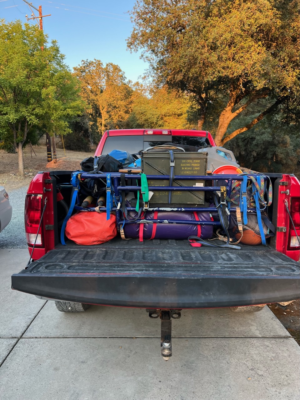
Heller Bar has a wet, slippery river rock takeout for rafts, while further downstream is a cement ramp for trailered powerboats. We considered taking a look at the cement ramp and then floating down there if it looked clear, but shortly after, several jet skis came upstream from that ramp and we decided we were better off staying where we belonged. Nevertheless, those rocks are very dangerous. We were lucky no one took a fall. Rick and I had to completely deflate both our cats and load our two frames and all our gear in a very calculated fashion onto the bed of our truck so that everything would fit. This was only our second time doing that so it took us a long time. Laura and Mark only needed to deflate the raft while leaving the cat inflated on top of their trailer. They had more room to not have to pack so meticulously, and probably had a lot more practice, so they were quicker. They took off ahead of us down the 20+ mile dirt road to Asotin, where the Scat machine was located to empty the groover. We met them later in town to say our goodbyes, and promise each other we would do this again together!
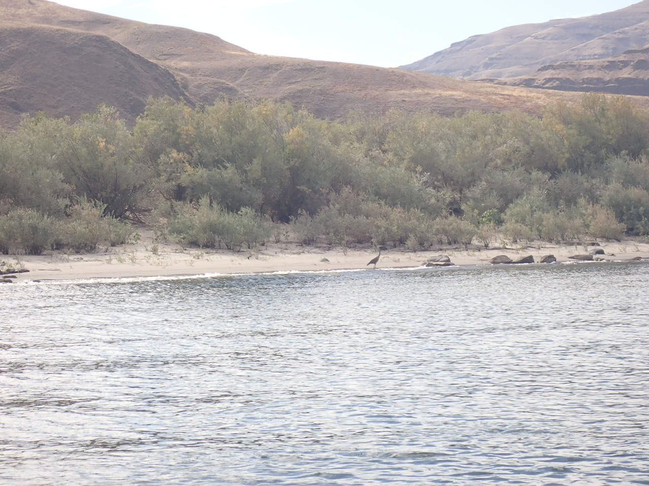
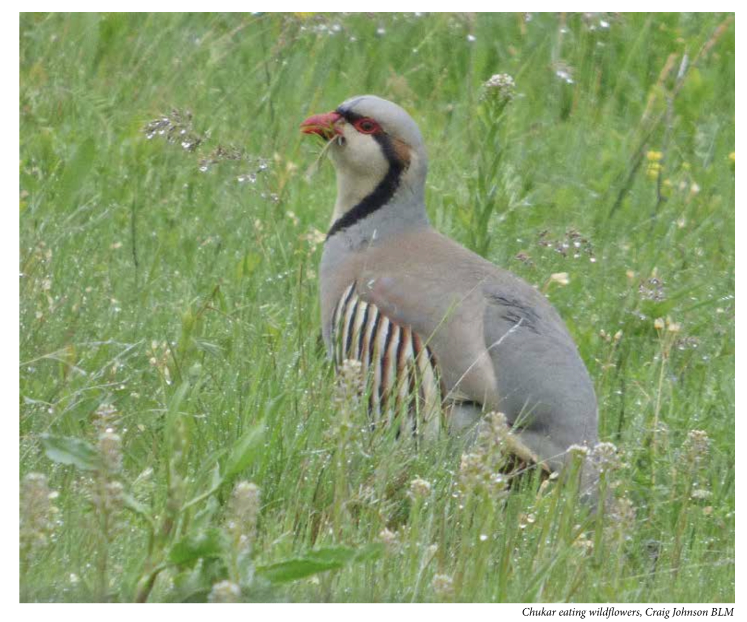
Laura later published a little post to Facebook where she described all the wildlife we had seen – she had kept notes. Our sitings included a “Screech Owl, a Great Blue Heron, a big toad, Big horn sheep, “Fucking Big” Spiders, four river otters, a little black cow (luckily Mark told Laura that there was a cow across the river, because from where she was sitting on the groover, it looked very much like a bear in the bushes 😜), two bald eagles, deer, Merganser ducks, many murders of crows, a medium big spider, a Great Horned Owl, another Bald Eagle, more Great Blue Herons, Bigass fish, Canada Geese, turkey buzzards, jumping big fish, miscellaneous birds, and Chukars!”
As Laura commented, all in all this little escapade was a much needed escape from the internet and the craziness of life. There were a few other groups on the river, but it was not crowded. We had no problem finding empty beaches to camp at, and only crossed paths with others a couple of times. We had no serious incidents, accidents or conflicts. We had great weather, clear starry nights, good food and good company.