
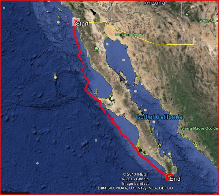
- Our track from San Diego to Cabo San Lucas, along the Baja Peninsula coast
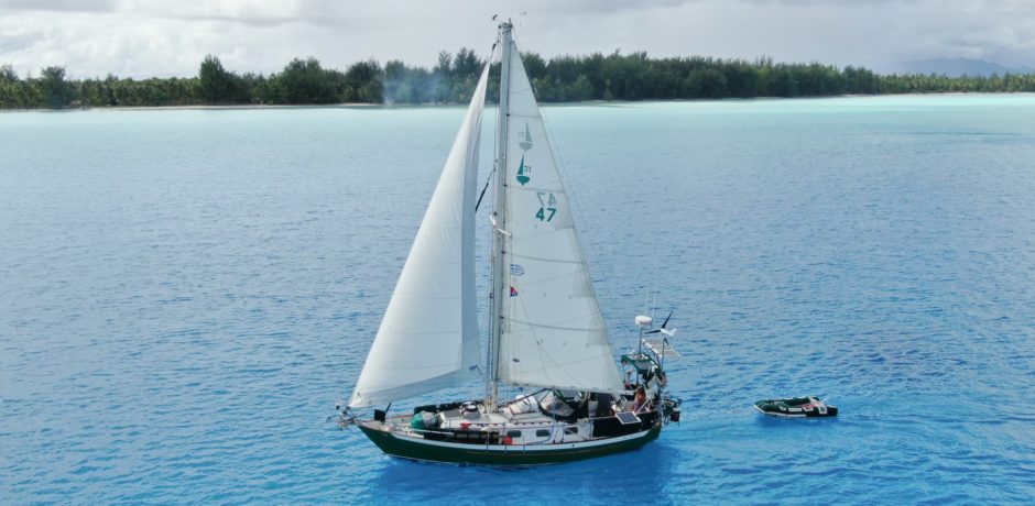
From October 28 to November 7, 2013, Rick and I crewed on s/v Adventure, a 38-foot, 1992 Island Packet, along with Captain Richard and first mate Susanne, from San Diego to Cabo San Lucas, Mexico, as part of the Latitude 38-sponsored event called the Baja Ha Ha, together with some 150 other boats.
All told, we travelled 863 miles by boat, underway for 171 hours, 75% of the time under sail without motor. We spent six nights at sea, broken up by two stops where were anchored for two nights each.

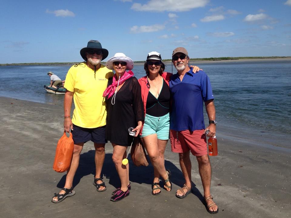
- Richard, Susanne, Cindy and Rick at Turtle Bay
This was the longest sailing trip that Rick and I have yet taken. It was a great experience. We learned a ton. And we are especially grateful to Captain Richard for having faith in us to crew for him, and for Susanne’s kind and supportive ways throughout the trip.
There is a lot to say, and I want to use this forum to document the trip, in order to make reference to it for planning next year’s trip. So skim over the details that don’t matter to you. Here is everything you ever wanted to know about our trip!
Before the Trip:
Captain Richard invited us down to San Diego to sail with him and Susanne, a couple of months before the trip. Great idea. We hit it off, got to check out the boat, and we all agreed we would be a good fit.
As to the planning for the trip, Susanne organized the food, which included Rick and I cooking our half of the dinner meals ahead of time, freezing them, and then bringing them down in a cooler as checked baggage when we flew down to San Diego on the Saturday before our Monday departure. That worked really well. Almost all of the dinners on our trip were frozen ahead of time and then just reheated.
In the few months left before departure, Captain Richard was aggressively prepping the boat. He had bought Adventure seven years before, from a guy who had fully outfitted it for cruising, but Captain Richard had since only sailed it in the mild conditions of San Diego bay and surrounding area. Adventure had all the equipment but much of it had not been used or even tested for several years. Captain Richard had earlier replaced the forward head with a porta-potty because the plumbing was unreachable; he replaced the aft head as well, in the final few months before departure. He bought a dinghy and motor; he researched, bought and installed a boom brake and associated rigging; he tested his asymmetrical spinnaker at dock, and figured out the rigging for that. He replaced much of the running rigging. Then the water pump on the engine failed just a few weeks before the trip. When it got replaced, the mechanic discovered that the engine’s heat exchanger had failed. After having it shipped overnight, the heat exchanger was replaced only a day before we left. He quipped that his advice to future HaHa’rs is to aim for having your boat ready for the HaHa in the year BEFORE the year you intend to go!
In the meantime, Rick and I organized a detailed passage plan, indicating what our recommended rhumb line would be to each anchorage, including waypoints suggested by some of the cruising guides. We spelled out all our recommended headings and how long to go on each heading, when and where to change course, how long each would take, etc.
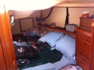
- Our private cabin

By the time we arrived in San Diego on the Saturday before the Monday departure, Captain Richard and Susanne had fully stocked the boat. The water tanks were full, gallon drinking water bottles were everywhere, and the galley was fully stocked. They bought new pillows for us and had our own private stateroom ready. It was delightful.
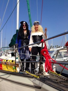
- Captain Richard and Susanne

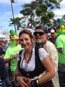
- Calico Jack and Lascivious Lucinda (AKA Rick and Cindy)

Sunday we enjoyed the Baja HaHa kick-off costume party at West Marine in San Diego, had a nice dinner out, and got to sleep early so we could get an early start in the morning.
Leg 1: San Diego to Turtle Bay
(Bahia de Tortugas, AKA Bahia Bartolome): 398 nm, 81 hours, 5.2 nm/hr average; max speed: 7.7 kts, sailed without motor 73% of the time)The Weather, Wind and Waves:
- San Diego on the Day of Departure
It was cool and overcast with intermittent showers when we left San Diego bay around 1100 on Monday, October 28. The wind was southerly. We began sailing from the harbor out into the ocean, but when we had to change our course to a more southerly route, we were heading directly into the wind and had to motor. We had planned to sail further out into the ocean, outside of the Coronado Islands, before heading southeast, but the “Grand Poo-Bah” (Richard. the editor of Latitude 38 and the flotilla’s leader), announced on the radio to stay well clear of the shipping lane and head inside of the Coronados, so we complied. When we occasionally tacked onto a heading of 130°M, we were able to sail, but otherwise, we motored. That was okay; the winds were light and variable so we made better time motoring anyway.
It wasn’t until about midday on the second day that the wind picked up. It had veered to the NW, the apparent wind speed was 16 kts, and we were sailing downwind at 7.3 kts, meaning that the true wind speed was roughly 23 kts! (We didn’t have a true wind reading so we had to estimate it based on point of sail, boat speed and apparent wind speed). The wind picked up all of a sudden. It remained steady, between 18 and 20 kts true, for another 24 hours. We didn’t log wave height, but I imagine they were 6 to 8 feet. The wind remained NW or WNW for the balance of the leg. In the afternoon of the third day, it picked up to 20 kts apparent downwind plus 6.5 kts boat speed, which was approaching near gale conditions, but then settled down again by nightfall, so much that we began motoring again around midnight.
We only wore our foulies leaving San Diego the first day; after that, we wore light jackets and caps, a little lighter each day.
The Boat:
This was the longest leg of the trip, with three nights at sea. This was also the shake-down leg: most of what would go wrong, went wrong during this leg. We were setting up systems for the first time, seeing how they would work, and modifying as we went along. Captain Richard did what he could to prepare, but inevitably, things will break or not work. The test of a true sailor is not avoiding mishap; they are bound to happen. The test of a true sailor is how they handle the mishaps when they do happen; and on that point, I think we all did pretty darn well.
That being said, we had more than our share of mishaps! Where do I begin? Well, let’s see: the SSB had lights but no sound; the VHF transmitted just fine but had very weak reception; RADAR went out, the GPS went out, and the autopilot went out, for starters.
Since the daily morning check-in was scheduled via SSB, we had to find a backup. The planned alternate method was to relay our location via VHF. However, due to our weak VHF reception, others heard our transmissions, but we could not hear their responses! This was a particular problem in the first leg because our courses were so diverse; Adventure was out to sea farther than most, so we were too far away from other boats to hear them clearly on our handheld radios. Because of the scheduling of our shifts, it was usually up to me to transmit our position; that second morning, I think I finally just transmitted it to the air, hoping someone would pick it up and relay it for us, and they did. I later found out that many ships heard my request for a relay assist and responded, but I couldn’t hear any of them. We were not able to find the source of the SSB and VHF problems, but at least we had our handheld radios as back up. (Lesson learned: unlike our US Sailing training, transmission of GPS location was expected in degrees and minutes only, not stating the decimal or anything to the right of it. I even heard just “32,11,117,12” for “32 degrees, 11 minutes North, 117 degrees, 12 minutes West”.)
RADAR was working fine when we started; I had set up guard zones and alarms, and we all felt more comfortable at night, knowing that if our eyes missed something, at least RADAR would advise us that there was an obstacle in our path. So when RADAR went out, it was very disconcerting. Again, we were not able to diagnose the source of the RADAR problem though we suspected it had to do with corroded connections within the system. We then had to rely more on the accuracy of the charts, including Navionics, which we were told could be off by as much as two miles, so we affirmed that our choice to stay well off shore was a good one. We also had to rely more on AIS, or “Automated Identification System,” which Captain Richard had loaded onto his laptop and was wired into the ship’s systems. For all other boats in the vicinity that transmit AIS signals, we had information on their course, speed, and proximity to our boat.
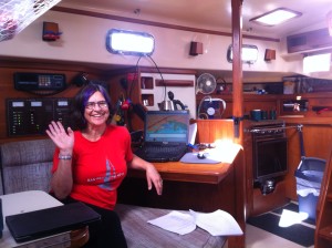
- Cindy with the computer, with AIS loaded

When the ship’s onboard GPS went out, that was serious. Not because we had no other source for GPS; we had at least four other GPS-equipped units on the boat. But the ship’s GPS was connected to the laptop computer that housed our AIS and was transposed to a working chart. The laptop still displayed boats, but no longer displayed our location in relation to them! That was not good. It virtually rendered AIS useless. Without RADAR and without AIS, we were flying blind at night, relying only on what lights our eyes could see. We needed to fix it. I had a GPS unit tucked away as a backup for emergencies. We connected it to the laptop with its USB connection. Nothing. But then I realized I had stored with the GPS, a CD containing software to allow the GPS unit’s readings to be seen by a computer. We loaded that onto the computer. Still, the AIS software was searching for a serial port to provide the GPS signal, not USB. Rick changed the default source from a serial port to “none” and Voila!, the AIS program found the GPS program and we had a signal once again! We had to keep my GPS unit plugged into the inverter for the remainder of the trip, but we had restored AIS! Woopie!
The loss of the autopilot was in some ways, a good thing. I, for one, was thankful for it. The autopilot lets you set a course and then it steers for you. That’s fine as long as the wind doesn’t change direction, or unless you have an emergency like an accidental jibe, in which case, problems can become worse during the few precious seconds it takes to release the autopilot and regain control of the wheel. It is probably essential while motoring during the day without wind during long passages, but we mostly had wind and weren’t motoring. Like other things, it was working when we first started out. Then, I set it, and the “set” didn’t take. I tried again, and it didn’t take again. Not until the last leg did it reappear. Not having the autopilot meant we had to hand-steer almost the entire 863 nm. There were several benefits to that, the most important to me was giving me hours and hours in the black of moonless nights without being able to see the waves or the sails, to make gentle adjustments to the wheel by feel only, to account for the tendency of the boat to head up when a wave is about to crest, and fall off in the trough, not to mention accounting for gusts, rogue waves, or, as it happened more than once, a passing boat. It kept me awake during those long night shifts, because I had to be an active and aware participant instead of just relying on the autopilot to lull me into dozing off with a false sense of security.
In spite of these and other equipment failures, in the big picture, we were lucky. We heard stories over the radio of boats loosing their engine, including one whose heat exchanger failed, the very piece of equipment that Captain Richard had just replaced; of a drive shaft uncoupling from the engine due to a propeller entwined in a lobster trap; of spinnakers ripping; and even of folks taking on the return, upwind bash back to San Diego after making it halfway, due to major damage. We were grateful for the last minute repairs that resulted in the motor remaining reliable throughout the trip. The hull’s integrity was never in question, and the sails remained in tact. We had enough drinking water and food for the entire trip. We were going to make it!
Navigation, Steering, Sail Trim and Communications:
Charlie’s Charts, one of the cruise guides, defines the distance between San Diego and Turtle Bay as 338 nm., presumably the most direct route and not accounting for wind direction while sailing. I am not sure if that is all the way to the anchorage or just to the entrance to the Bay. Our “rhumb line” route totaled 353 nm, probably because we planned a course further from shore for safety reasons. We had planned a course out into the ocean southwest of San Diego for about 13nm and then a rhumb line course in a straight line for another 286 nm. Of course, it didn’t turn out quite like that; the wind direction wouldn’t let it. The rhumb line course was 150°M, and instead, during the long stretch passing by the Bahia Sebastian Viscaino, we tacked between about 120°M and 210°M. In the end, we sailed 398 nm, meaning we managed to sail most of the time and only had to add 14% greater distance travelled, compared to our planned route. Our farthest distance off shore this trip was about 50 nautical miles.

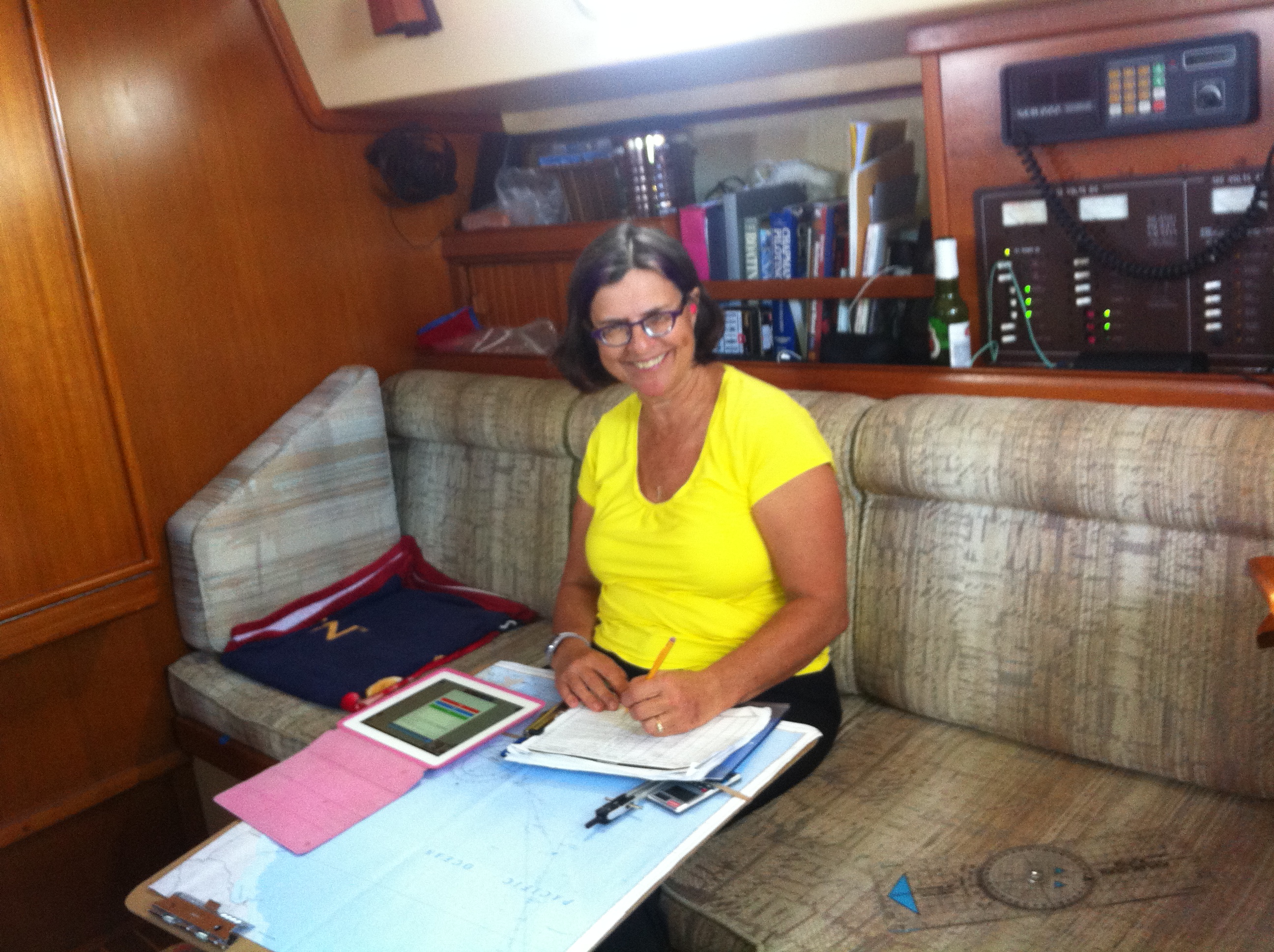
- Charting on our chart board
Navionics at the helm on my iphone worked well for giving us a quick glance of how close we were to our desired route, where we were in relationship to land, our Speed Over Ground (SOG), how far we had to go, etc. Navionics on my ipad in the cabin worked pretty well for tracking our course, but we kept a written log as well, and charted our location on paper charts. Rick and I maintained the logs and charted our locations. That worked well since between the two of us, we had 100% of the shifts covered; we were never on duty at the same time, and with the exception of one hour per day, one of us was always on duty while the other was off. We tried to log every hour, but sometimes, that stretched to two hours, either because we were on an unchanging course, or because a lot was happening and we didn’t have time. Our navigation methods, however, were on the whole, successful. We pretty much always knew where we were, where we were going, how to get there and how long it would take us to get there. We changed course when we needed to. We got there when we said we would, we didn’t have to backtrack at all and we didn’t hit anything in the meantime! The one BIG disappointment we had with Navionics is that it would maintain a track for only about 70 nm or so, and then start a new track without notice, so the cumulative distance travelled was not available from Navionics, and the only way to get a picture of the track of the entire leg was to superimpose all tracks on top of each other. And for some reason, some tracks didn’t save at all. Very bad. On top of it, the ship’s log indicator was broken, so we had no ship speed indicator (through the water) and we had no ship log. Without an indicator through the water to compare to SOG, it is difficult to determine the effect of currents. Captain Richard’s handheld GPS unit was the source of the boat’s official distance travelled.
Once we were out of visual contact with land, there was nothing to visualize to set a course during the day except by using the compass, the wind, or the wind instruments. The bimini prevented us from seeing the wind direction indicator at the top of the mast. I had a hard time with that at first; I had really come to rely on the wind indicator at the top of Cool Change’s mast to confirm what point of sail I was on. But I grew to rely more on how the sail felt, how the boat was responding, where the wind was on my head/face, and perhaps too importantly, where the wind was showing on the electronic wind direction indicator at the helm. It was good to learn how to use that indicator more than I ever had before, but starring at any instrument for a long time is not healthy, whether it be the compass, the wind indicator, or otherwise. So I would just sail according to what felt like it was keeping the sails full but right at the edge of the jib winking, and if I felt like something was changing, I would take a look at the wind indicator. As it turned out, the course heading wasn’t so much the goal, as it was to remain as far down wind as possible, since the closer to downwind we could be, the closer to the shortest distance to the goal we would be. Maintaining a course of about 160° to 165° off the wind was the safest, it seemed. We had a Dutchman boom brake, but it was unpredictable. Sometimes it would slow the boom down considerably in a jibe, and sometimes it wouldn’t slow it down at all. Rick’s theory was that the brake where it attached to the boom at the vang was too close to the mast to effectively dampen the swing of the boom in a jibe. So we had to be very careful about avoiding an accidental jibe, especially during higher winds.
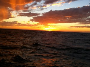
- One of the many gorgeous sunsets

At night, there was an added steering aide: the stars. Over the course of the night, the constellation locations obviously change, but for an hour or so at a time, I could use the same constellation to steer to, and then find another. At least for some of the time between 2200 and 0200 each night, rather than focusing on the compass or wind indicator, I could keep Orion’s Belt in view just to the left of the mast on a port tack and that would keep me on course.

- Spinnaker
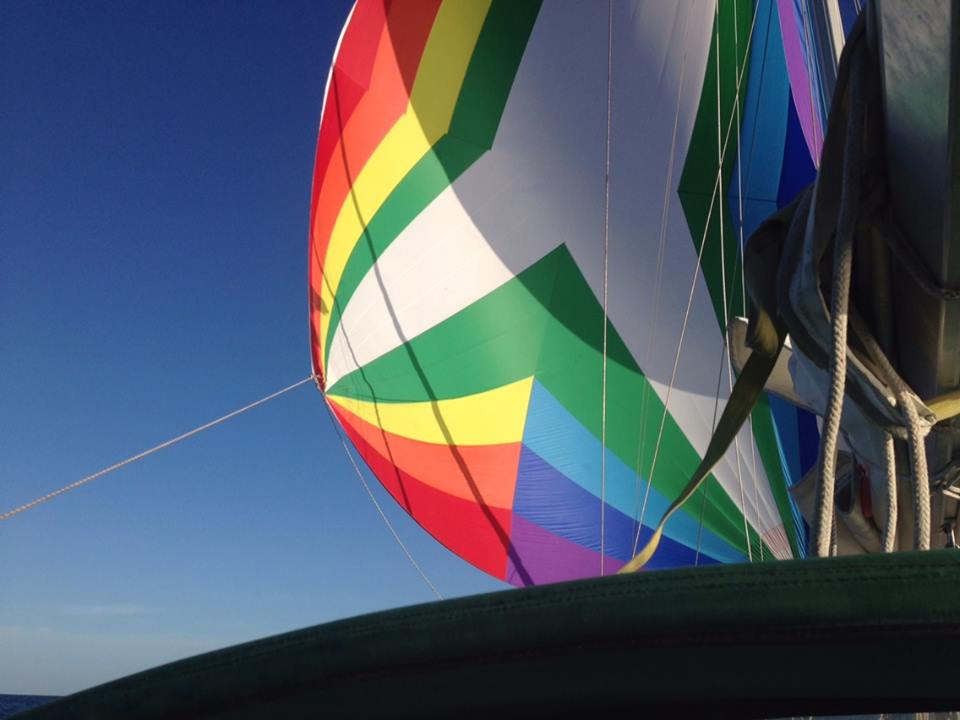
When the wind direction and strength finally seemed appropriate on the second day, we deployed the assymetrical spinnaker. Captain Richard went to the foredeck and hauled up the spinnaker and then raised the sock. The tack of the spinnaker was attached to an adjustable pendant. It was fun to adjust the length of that pendant and the amount of sheet deployed, and see what the effect they had on the stability of the spinnaker. It got wrapped around itself a few times, but basically, we sailed it pretty successfully for several hours. However, as the sun became lower in the sky, the wind picked up, and we realized it was time to sock the spinnaker. Easier said than done. After a very amusing swearing soliloquy, instead of socking the spinnaker, Captain Richard ended up having to gather up the spinnaker on the foredeck as Rick eased the halyard at the mast, tying the spinnaker down where it would remain until we arrived at anchor a few days later.
We also noticed on this leg, some problems with furling the genoa. It would not furl, so at the end of the leg as we approached Turtle bay entrance, we had to douse the genoa as well, and tie it down to the foredeck. It turned out that the culpret was the spinnaker halyard. It had been tied off forward instead of midships, and was causing a wrap on the forestay when furling the genoa. We had had a similar problem on Cool Change, so Rick first sensed the cause. Rick and Captain Richard worked that out at anchor and fixed it.
As far as communications were concerned, our problems with the SSB and VHF radios made communication difficult. It took us a while to discover that at least our VHF radio communications were being heard, albeit we could not hear the responses unless the boats were within just a few miles. The VHF equipment malfunction was less of a problem on the second and third legs, where the route was somewhat more uniform, so more boats were in closer proximity. Captain Richard also had an InReach Satellite system on board, that transmitted our location every four hours, and was available for viewing from a website. It could transmit more frequently, but it operated on battery power whose depletion was related to frequency of transmission. He could also send and receive texts using that system. I noticed later that the track showed an inaccurate jump in our location backwards at one point; I am not sure what happened there. But overall, it seemed like a reliable system. We also had an EPIRB – an “Emergency Position Indicating Radio Beacon” (actually a satellite transmitter). Had we needed to, activating the EPIRB would have let the US Coast Guard and other official emergency response bodies know of our location.
The Crew:
It was hard for all of us to get used to midnight shifts on the first leg, so we were all a bit sleep-deprived. And we were just getting to know each other. This was the culmination of a 20-year dream for the Captain, who almost wasn’t even able to cast off the docklines due to engine problems that didn’t get resolved until the last minute; he was relieved but still seemed a bit skeptical about how far we would really get! He even had us leave the dock lines in place on the deck, in case we had to return to a dock quickly! On the other hand, Captain Richard fully embraced his Captain responsibilities and was always there to address whatever came up, and respected the input of his crew. Rick and I had a “can-do” attitude that I think helped, but we also brought with us some “must always do” seamanship practices that the Captain was not necessarily accustomed to. Susanne had the galley thing dialed, but was a little nervous about being assigned watch duties.
But all in all, we had a ball. No one got sea sick. We laughed so hard at all the mishaps, that we all practically fell out of the cockpit giggling about it. We performed a series of skits for the Captain’s birthday, re-enacting some of the funnier moments in our first leg. Some of those moments included a repeat of the Captain’s swearing soliloquy on the foredeck when attempting to sock the spinnaker (F@#k, F@#k, F@#k, F@#k, F@#k … repeat 10 times … like a chicken clucking); carrying a dishpan full of water to mimic a full porta-potty tank with a faulty closure up the companionway and pouring it overboard); and making fun of the Captain’s public VHF admonishment for calling the Grand Poobah, “Sir”. It was a great bonding experience.
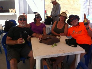
The Party:
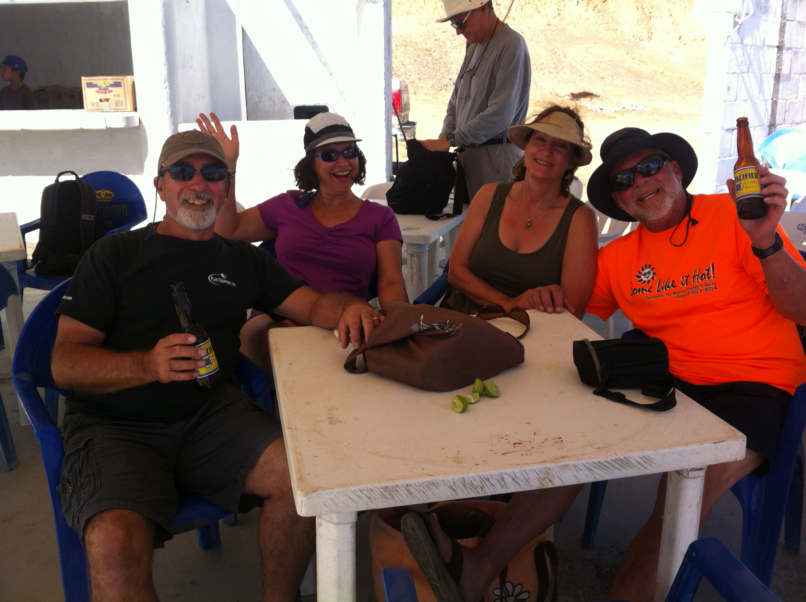
- Turtle Bay Party

Every member of our team had a great feeling of success upon arrival at Turtle Bay (Bahia de Tortugas) on the morning of Thursday, October 31st. We had sailed almost half way. It was already the longest trip Rick and I had ever taken. We all indulged ourselves in showers on the boat. Rather than taking the dinghy off the davits, we called over a local motor boat (panga) to transport us to shore. We walked around town, had a few beers, had some tacos, and revelled in our success. We all liked each other and our team was cemented.
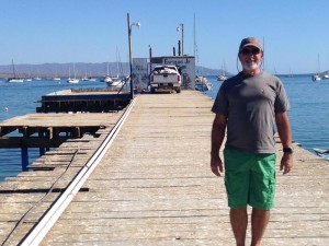
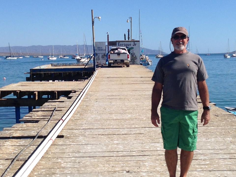
- Rick on the dock at Turtle Bay
The town has a substantial, if not well-maintained, dock, several little semi-permanent cantinas on the water, a few square miles of dirt roads with cement-block houses and shops stacked close together, several small groceries, a handful of restaurants and cantinas, and a large baseball field with permanent, cement, covered stands. Oddly, this entire town infrastructure is only for the purpose of supporting a large group of fisherman for the short period of a few months each year, according to a police officer I spoke with. In any case, we were there at the right time, I guess, as the Baja Ha Ha always is. Apparently, for example, they open the restaurant up the hill designated for the Baja Ha Ha cruisers, just for the cruisers! Actually, it seems very odd. This small, sleepy, part-time fishing village becomes inundated by nearly 500 mostly non-spanish speaking gringos once per year for two days, and then they all leave. All of the toilets we encountered seemed inoperable, probably because their septic systems just weren’t designed for absorbing so much, so fast!
But the townsfolk seemed happy to see us, and I would imagine that a lot of the locals made a lot of money that day. My only regret is that we failed to bring anything to give to the kids; it was Halloween, and although Halloween candy is not a tradition in Mexico, the kids in this town have grown accustomed to candy gifts from the gringos. So we had a lot of kids coming up to us, some even in costume, saying “Trick or Treat”, and we had nothing to offer. Next year …
- Turtle Bay Partiers

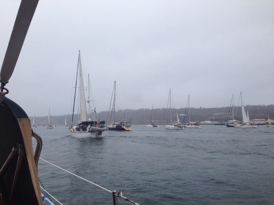
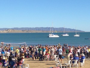
Turtle Bay was a wonderful first glance at Mexico, and it was very welcome change to be at anchor and sleep the night through. The weather was warm and inviting, and the cruisers were anxious to meet each other and tell their stories. The party on the beach the next day was filled with all the icons that Bajahaha’rs had come to expect: the Conga line, the abundance of potluck foods, lots of beer and margaritas, the tug of war between women and men (4 to 1 required), dancing, and the Grand PooBah reining over it all.
- A panga

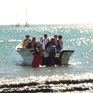
In spite of being warned about it, we did manage to confront a problem that many Baja Ha Ha cruisers confront when returning on a large panga at night from the town to their boat: where is my boat? With 150 or so boats in an anchorage, they all look the same! We were so excited to get on shore the first day that we failed to leave any lights on, nor turn the anchor light on. So not only did we not have anything to distinguish our boat from others, it was completely dark to boot! We did have a fairly clear idea of where we were anchored in relation to the boat dock, but with so many people on the panga shouting directions to their boat, we had to wait until most of the boat was empty before we were able to clearly instruct the driver on how to get to our boat. On the other hand, boats with bright purple glowing lights halfway up the mast were the easiest to see. This would be one good argument for why one might want to take their own dinghy to the dock, rather than relying on the pangas. At Turtle Bay, this would have been possible. At the next anchorage, not so much, due to the significant surf.
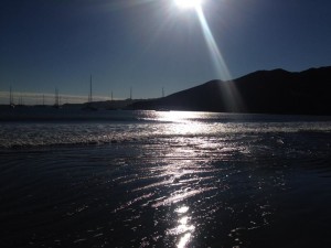
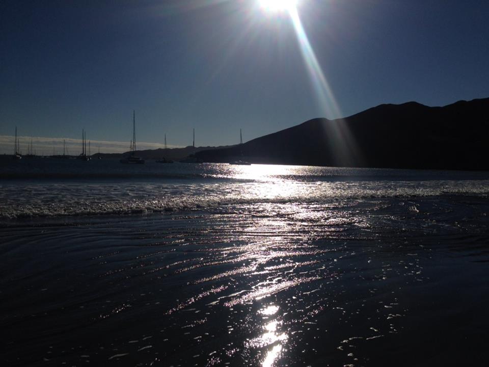
- Approaching sunset at Turtle Bay
But at one point, Captain Richard said to me that even though Turtle Bay is nice, he had already begun to miss being at sea. He wanted to get back out there. So, on we went ….
Leg 2: Turtle Bay to Bahia Santa Maria
(280 nm, 55 hours, 5.2 nm/hr average; max speed: 8.2 kts, sailed without motor the whole way)The Weather, Wind and Waves
We weighed anchor at around 0800 on Saturday, November 2nd and crossed the start line about 1000. The wind direction varied between North and WNW throughout the entire leg, and was so steady that we were able to sail the entire race, motoring only in and out of the anchorages. At the beginning, the wind was NNW at about 11 kts apparent, together with our SOG of 4.3 kts, making for true wind of about 15 kts. Later in the afternoon, it picked up to about 21 kts true, remained fairly consistent throughout the night, and peaked again the next afternoon at about 1600 at almost 27 kts true. The seas were bigger on this leg; my guess is that they were 8 to 10 feet – enough that while standing in the companionway looking aft, the waves appeared to tower over the helmsman as they approached. A heavy displacement boat like Adventure doesn’t make a max speed of 8.2 knots without current at sea unless it is surfing some pretty significant waves! This was not the mild-mannered, walk-in-the-park stroll down the coast we had been promised!
But it was fun. And challenging. Richard had managed to untwist and resock the spinnaker, and we dared deploy it in the calmer morning hours, enjoying the increased downwind point of sail it provided us. But then we socked it away successfully before the wind picked up too much later in the afternoon. Taking care not to accidentally jibe, especially with the bigger seas that tended to increase yawing, became more important than ever, since the wind was stronger and the likely damage greater.
The first night out on the 2nd leg was a bit white-knuckled for all of us. It was still nearly moonless, and dark, except that this time, there were a lot more lights around us – most boats were taking very similar courses. At one point I counted lights on at least 18 other boats within view. And most boats were sailing, so we were all tacking back and forth across mostly the same rhumb line, increasing chances for a collision. It was very difficult for me to figure out how close boats were and whether we were on a collision course. By this time, Susanne had decided not to take the wheel at all at night, for fear she might jibe, which left the other person on watch to steer. With the lack of an autohelm, opportunities to view AIS down below in the cabin were rare. At one point, I saw a boat that appeared to be approaching from my port, but I saw its white light first, a light that eminates from the stern, making me think the boat was ahead of me and I was going to pass it on their starboard, my port. I thought about it and decided that if I needed to change course to avoid them, I was going to have to sail upwind by steering to the left, since steering to the right would result in a jibe. At least I had thought that out ahead of time, although heading upwind in a near gale with 10 foot seas was not appealing. And since they were coming from my left, I would turn into them unless I turned left before I got to them rather than waiting to turn until collision was imminent! But then as they approached I saw their green light, a light that is on starboard (the right side) at the bow. That meant I was seeing the side of their boat, not the stern. But in big seas and big winds in the dark of night, it is sometimes hard to make sense of the facts before you. I asked Rick, who happened to be stirring below, for his opinion, and then shortly after that, the boat ahead flashed a white light on its sails and it all became clear: if I didn’t head upwind almost immediately, I would sail directly into them on their starboard side in a matter of probably less than a minute or two. Furthermore, they were on a starboard tack and I was on a port tack so they had the right of way, not that it mattered at this point; I had to do whatever was necessary to avoid a collision. I headed up immediately and all was well … once I started breathing again! That was scary. I arranged to have a flashlight like theirs in our cockpit too, so we could shine a light on our mainsail too at some point if necessary, if someone in another boat hadn’t yet learned the lesson I just had.
Later, Rick and I discussed it. Colored lights on boats at a distance look faintly white. Colored lights are required to be seen at two nautical miles; let’s just say one nautical mile to error on the side of caution. At 6 kts boat speed coming towards each other, two boats will collide in 5 minutes. So, once you see the colored lights, you’d better think fast and take action. I just can’t imagine what would happen instead of meeting another sailboat, to meet a tanker at sea who is not going 6 kts, but 20, and has only a few lights on that are so high they look like stars. RADAR and AIS at the helm seem to me to be essential.
The events of the first night shook up Susanne so badly that she had a hard time being on deck the second night, when the wind and waves grew even greater. Rick was at the helm for the 0200 to 0600 watch, and he was getting overpowered. The helm was not responding like it should, due to the building wind and seas. Already on reef one, Adventure’s mainsail needed another reef. Rick was about to send word down to the crew below decks that he needed an assist to put in the second reef when the boat yawed on a large wave and caused an accidental jibe. The boom brake did little to ease the load on the rig. Rick sent Susanne down to wake the Captain up, and then to wake me up and we worked together to put in the second reef. Someone needed to remain at the helm due to lack of the autopilot system. Fortunately, nothing broke. Adventure is reefed entirely from the cockpit, which was very important that night. Under two reefs, better control was returned to the helm.
The Boat
In addition to the equipment failures observed in Leg One, a few more popped up in this leg, most notably, one of two 5-gallon fuel reserves on the forward deck washed overboard, never to be seen again. The Captain learned that bunghy chords just don’t make it. It didn’t seem to be a big problem at the time, since we hadn’t motored any of Leg Two, and the main fuel tank still showed a healthy reserve, but this was to later change. Unfortunately, there was no refueling station at the second landfall like there was at the first.
We also observed how freyed the furling line for the genoa had become.
Navigation and Sail Trim
Much of this leg was “off the charts”, since we had coastal charts and we headed away from the coast, or better said, the coast headed away from us in another big bay between Turtle Bay and Bahia Santa Maria. We just attached blank paper sheets with parallels and meridians drawn on them to chart where we were off the coastal chart. We were slowed down a bit in the first third of the trip, when the wind shifted and required us to tack well off our rhumb line for a while, but then it shifted back, and our “distance made good” was much closer to the rhumb line.
It was good to finally get a handle on operating the spinnaker sock and getting it back down in reasonable winds. We also liked the adjustable pendant at the tack, which is apparently not standard, and found we could sail more downwind if the pendant had ample length. Rick and I both saw the advantage of reefing the main from the cockpit, unlike Cool Change, which has this hybrid arrangement that leads the halyard to the cockpit but requires reefing at the mast. We’re planning on changing Cool Change’s configuration to reef entirely from the cockpit, like Adventure’s rig does.
The Crew
Again, no one got sea sick. I continued to use the Scopalomine patch, removing the first when we got to anchor and putting a new one on at the start of the second leg. I am not sure that was necessary, but better safe than sorry, especially since I needed to be down below reading charts and writing in the log once an hour, regardless of the sea state. Rick, with his Greek sailing heritage in his blood, didn’t need to take anything and didn’t feel a thing. I believe that the Captain and Susanne both might have felt a little uneasy, and that was exacerbated by the fact that the “owner’s cabin” was forward, and therefore, subject to more rolling and yawing.
We continued to all get along, with very few “incidents.” I think the Captain started trusting Rick and me more, and even, perhaps, began to depend on us for more than just an extra hand; he actually turned to us for our expertise! That was a good feeling. At the same time, Susanne just wasn’t feeling comfortable at the helm – she was just too new at sailing to accept the challenge that these seas and wind presented – but at least she recognized that, instead of putting any of us at risk. She continued to help in whatever way she could, she attempted to at least be in the cockpit during her watches, even at night, and she took on many more of the galley duties. Each to their own abilities; we were still a great team … In the meantime, to be frank, I was missing sleeping with my husband! At 1700 each day, for one hour, we were both off the helm, so a few times, we slipped away into our cabin and shut the door. It was nice to be intimate together, even if it just meant having a private conversation.
A note here, also, about Spanish. I had billed myself as fluent, having achieved fluency while living in Mexico for four years, some time back. But I secretly had some insecurities about how well my Spanish would come back to me. Gratefully, it was like riding a bike; once you learn, you never forget, or something like that. Granted, my Spanish was slower and more deliberate than my Mexico days, and sometimes my brain processing time for finding the right word was a little longer than usual, but sure enough, the words I needed to say just poured out without translation or conscious thought, as if I was observing someone else speaking through my voice! And understanding came similarly painlessly. What a relief!
One detail in my Spanish lexicon returned to my consciousness just in the nick of time: Susanne and I needed to buy some eggs in Turtle Bay. As we walked into an abarrotes (small grocery store), a faint memory started resurfacing that there was something I had to be careful of when using the Spanish word for an egg (huevo). You’d think that the plural of “huevo” would be “huevos”, but not … No matter how many eggs you need, when using the word without an adjective to clarify, ask for “huevo”, not “huevos”. “Huevos” is slang for balls, as in, “boy, does that guy have balls!”
I am not sure how necessary it was to have someone along to speak Spanish; the large majority of the boats did not, and they probably did just fine. But I do know that I seemed to be using it pretty much constantly whenever we needed to communicate with the locals, whether it was giving directions to the panga driver to get us to our boat, getting directions while motoring through the Cabo marina from passing commercial fisherman to find our dock, ordering food, finding groceries, or just getting some more intimate details from the locals about the the places were were visiting in order to get to know them better. Even if on the HaHa you can get along without it, the experience that Rick and I will have in our planned 16 months in Mexico will be greatly enhanced, I know, by speaking Spanish. Rick is hard at work at learning Spanish, too.
The Party
- Adventure Crew at Bahia Santa Maria Lagoon at Bahia Santa Maria
Bahia Santa Maria was very different from Turtle Bay. There was NO town. There were, however, a few cement buildings on a bluff above the beach, just where the lagoon joins the bay. And not too far away, in the next bay over, there was quite the sportsfishing industry, so there were some pangas available for transportation to and from the beach. At least this time when we left on a panga, we kept our anchor light on, and we were way on the eastern edge of the anchorage, so we were easier to find.
The party on the bluff above the beach the day after our arrival was “catered”. Well, in a manner or sorts. We made the mistake of taking a short hike when lunch was being served, so we missed out on the fish stew, but all in all, it was fine. There was dancing again, this time with a live band who brought their own generator! The beach went on for miles, just like at Turtle Bay, and invited the adventurous to stroll to their heart’s content.
Upon our departure, we ran into a bit of a snag. The windlass broke! Actually, the chain stripper on the capstan that prevents the chain from winding around itself, had broken off before the trip. The Captain had repaired it but the fix didn’t hold. So the Captain and Rick had to haul the chain up manually. That would have been fine, but in the calm conditions, the Captain had deployed the main before he went forward to weigh anchor. The wind picked up and we started sailing, right towards a nearby boat who was also weighing anchor! I was at the helm when the woman from the other boat yelled, “Ease your mainsheet!” Clever idea. I did so, and our swinging towards them subsided significantly. Yet another lesson learned.
Leg 3: Bahia Santa Maria to Cabo San Lucas
(190 nm, 35 hours, 5.4 nm/hr average; sailed without motor 39% of time)This was the final and shortest leg of the trip, but the wind didn’t cooperate. It had veered to ENE to start. Not only was the wind light, but it kept changing direction, from NE to ENE to WSW (?) and finally to ESE. The seas were choppy but the waves were small. It was warm, warm, warm, without being hot, and we were all comfortably sailing in shorts and t-shirts.
Wanting to arrive in Cabo during daylight the next day, we decided to leave the anchorage very early on Wednesday morning, November 6. We weighed anchor at 0300. While leaving the bay Rick would occasionally flash the spotlight at the bow to look for lobster rigs and nets. Each time he would flash the light he could see Squid jumping out of the water trying to elude predators. We later would find many of them on the deck where they would have inadvertently landed. After leaving the bay, we attempted to sail for about six or seven hours and then finally, started up the motor. One of the Captain’s dockmates in Chula Vista told us about his “3-30” rule: if he sails making less than 3 kts for 30 minutes or more, he turns on his engine. We liked that rule and followed it ourselves. But it wasn’t so much the lack of wind as it was our “distance made good” that failed us. After one particularly challenging couple of hours tacking back and forth across the rhumb line, I calculated that for every 7 nm sailed, we were making only one nm progress towards our destination! (That was probably when the wind changed to ESE, our exact desired course.)
Anyway, once we realized we had to motor or we would be out there “forever”, the Captain became concerned that we didn’t have enough fuel. Our fuel gauge had been reading a quarter full for quite some time now. We didn’t know how reliable it was (note to self: let’s calibrate Cool Change’s fuel tank again before we leave!). We could run out of fuel at an inopportune moment. Captain Richard and Rick had already poured the one remaining 5 gallon spare fuel tank into the main tank, and now that was spent. During the 2nd morning check-in, I casually mentioned that we might be looking to find someone with a 5-gallon fuel jug to spare.
I immediately got several offers. One was from Apsaras, a Hunter 450. We exchanged lat-long positions, and he pointed out that we were roughly a mile away from them, directly west! It took me a minute to figure that out for myself. I understand lat and long, but I have so often just used it as a point, not in reference to the bearing and distance to another point. We were at the same latitude, and our longitude was only a minute off, his less than mine. Of course, I realized, that is only a mile! If I just head due east and he heads due west, we will meet in a half mile!
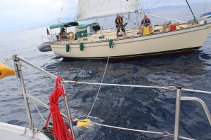
- Fuel Transfer at Sea
We each discussed which side of our boats would approach each other so that we could protect them with fenders. When we came within sight of each other, they swung up around us from behind and approached our starboard with their port. Each of us behind the helm sort of danced around each other. It is one thing to approach a stationary object; it is another to approach a moving boat! We would come close to one another and then veer away, we would slow down and speed up, trying to find a safe distance apart so the waves and wind wouldn’t push us together (both of us had a mainsails up), but close enough so that a line could be thrown from our boat to theirs to tie on the fuel can. In the meantime, Rick identified a heavy, long line he could toss over to them, and set himself up to toss the line when the circumstances were optimal. If he missed and the line ended up in the water, it could end up in either of our propellers, so it was important he tossed well and they were prepared to catch it! This was all discussed on the fly, of course, yelling across from one boat to another, without really having a plan before we came close to one another for how we were going to do this!
But somehow, it all came together. The boats were close to one another, maybe 10 feet, but heading away. Rick confirmed they were ready, and tossed the line. They caught it! They tied the fuel jug onto the end of the line, and tossed it into the ocean. It floated. Rick hauled on the line and soon, we had 5 gallons more of fuel!
Land, ho!

- El “Arco” where the Sea of Cortez and the Pacific Ocean meet, at Cabo San Luca
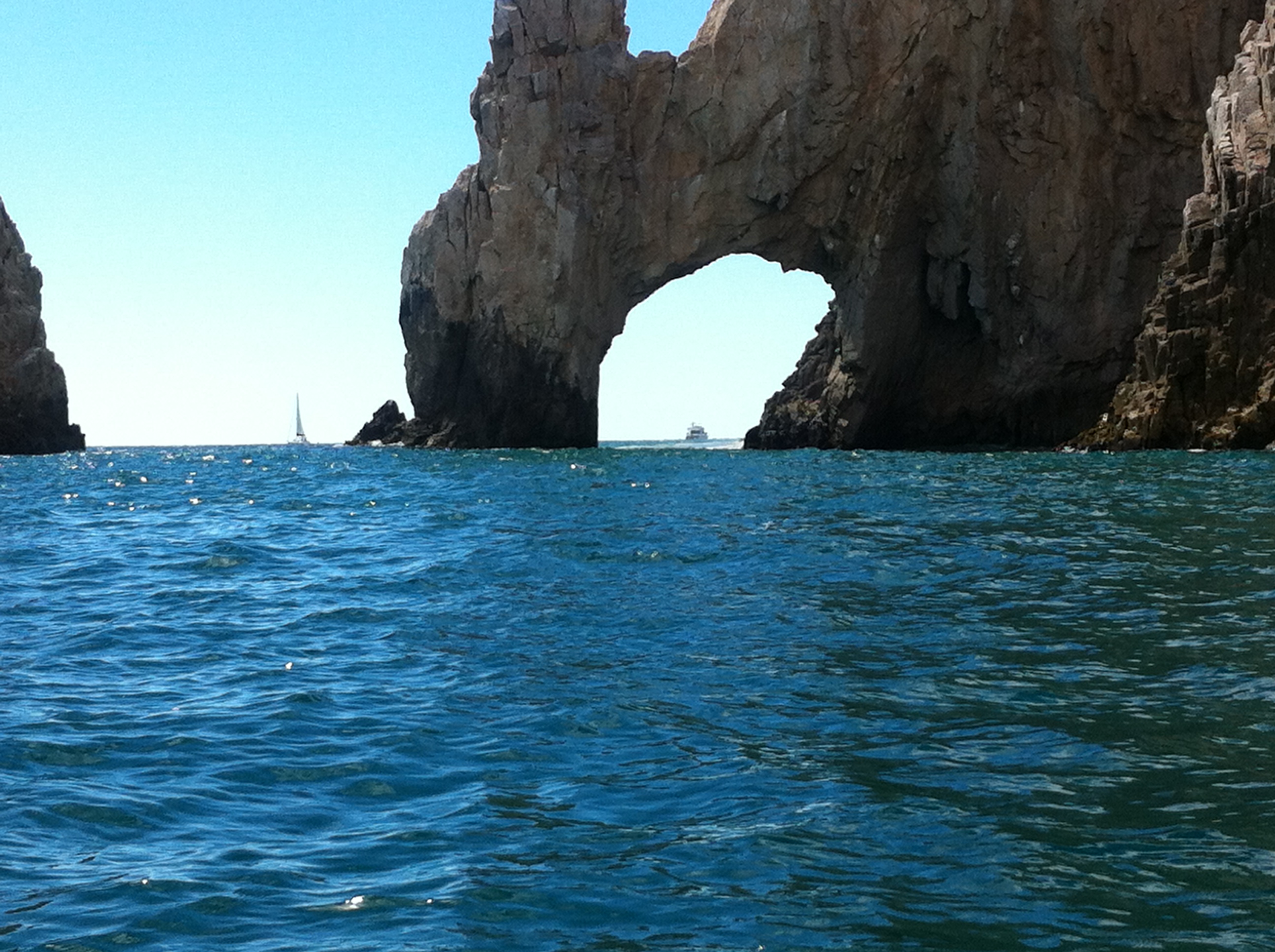
We made it into the Cabo harbor, leaving probably more room around the Cape than necessary, at about 1400. Captain Richard had a map of the harbor, and we had been assigned a slip by the Grand Poobah via radio relay during our last leg, but what we saw when we entered the breakwater did not match the map. Unbenounced to us, the breakwater entered us into the harbor but not into the marina. The marina was indeed, off to the right.
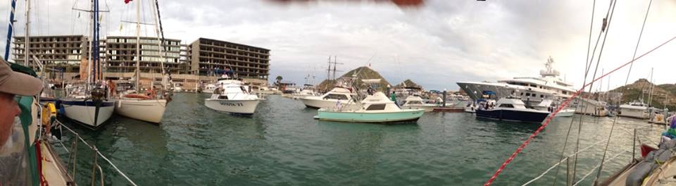 Busy marina at Cabo San Lucas
There were so many boats everywhere: commercial fishing boats, sport fishing boats, sailboats, huge superyachts; it was mayhem! The good news was that there were so many people around, you could yell over to anyone and they would hear you, so we asked where our dock was and were pointed in the right direction. When we finally found the end-tie we were assigned, there was someone already there, and the fuel dock was directly across from the end-tie. Motorboats were “parked” perpendicular to the fuel dock, awaiting their turn, and blocking our entrance. I was behind the helm and the Captain hadn’t taken it from me, so I assumed he was good with my proceeding as though I could do this. I remained calm and recalled all of my repeated classes and practice in Big Boat Motoring in Tight Quarters! I yelled over to the boat already at our end-tie, to please make room for us by moving his dock lines to tie up closer to one end. He did. I made a very tight turn in a narrow fairway, and headed back towards our dock. Somehow, I squeaked in between him and the perpendicular motor boats, then pulled alongside the part of the dock in front of him. I used the old trick that one of our instructors, Thomas, taught me: line the boat up next to the dock, but then to get it closer to the dock, idle the engine, put the transmission in neutral, straighten out the wheel, and then turn the wheel sharply away from the dock, put the engine in forward and give one big rev on the throttle before bringing it back down to idle in neutral. Theoretically, the whole boat eases its way over to the dock, like magic. And like magic, it did! I love that trick. We were at a complete stop and the fenders were rubbing the dock. The Captain stepped off, Rick handed him the docklines, and we safe at the marina!
We couldn’t wait to take a long, long, long shower. As soon as the Captain was back from checking in at the marina, that is exactly what we all did. We’d planned on eating the filet mignon we had been saving for arrival, but before we could, the Mexican Agricultural Office came aboard and took any beef or vegetables we had remaining.
Cabo is an extremely touristy, Gringo-ized, rich and glitzy City that bears little resemblance to the rest of Mexico. However, as the first marina we saw after our longest passage ever, Cabo’s marina will always hold a very special place in my heart.
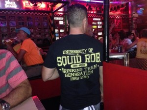
- Squid Roe in Cabo
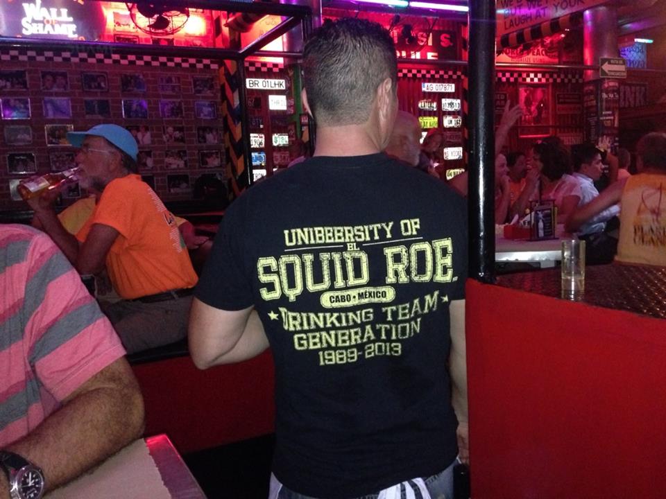
That night, we attended the “Can’t Believe We Cheated Death Again” dance and party madness at Squid Roe on the main drag. After Susanne and I made a feeble attempt to dance together alone on the disco platform, I knew it was time to go when some exotic Mexican senorita waitress got me to open my mouth and inserted a jello shot down my throat. The Captain did manage to return the empty fuel jug to its rightful owner and reimburse them for their trouble. After a quick bite to eat of some Tacos al Carbon at a streetside cafe, Susanne and Captain Richard went back to the boat, and Rick and I took a walk around town.
The next morning, we took on the ordeal of checking in with the Mexican authorities. We walked the 10 blocks or so to the immigration office, and then waited in line there for about 30 minutes. Captain Richard had all his documentation in order, but that didn’t stop them from being somewhat discourteous to him. We had to go through the line twice; once to get the paperwork we needed to fill out, and the second time, to turn in the paperwork and get stamps on our passports. The next stop was about 15 blocks back where we came from. Another 45 minutes or so for the first line, and then another 15 minutes or so for the second line, and we were done. It pretty much took the whole morning. And this was with having paid on line before we left the States! It would have taken even longer without that. Alternatively, we could have paid $60 to an agent who would have handled the paperwork for us. However, there were reports of some people not getting the right paperwork back from the agent, resulting in problems when trying to fly out of the country, so I think it was best we did it on our own.
That afternoon was the Cabo Beach Party. Lots of food, lots of drinks, lots of sand and sunny beaches and beach vendors. That night, our last night together, we went out to eat at Los Tres Gallos, a lovely Mexican restaurant off the main drag, set in a garden atmosphere with the best wait staff one has ever experienced, comparable only to the excellence of their mango margaritas!
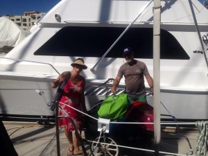
- Susanne helping Rick and I disembark at Cabo

It was sad leaving the Captain and First Mate on Saturday morning, but Rick and I were scheduled to move on to a whole other chapter: renting a 5,000 square foot luxury villa overlooking the Pacific Ocean with my sisters and their husbands just outside of downtown Cabo. Another story altogether …
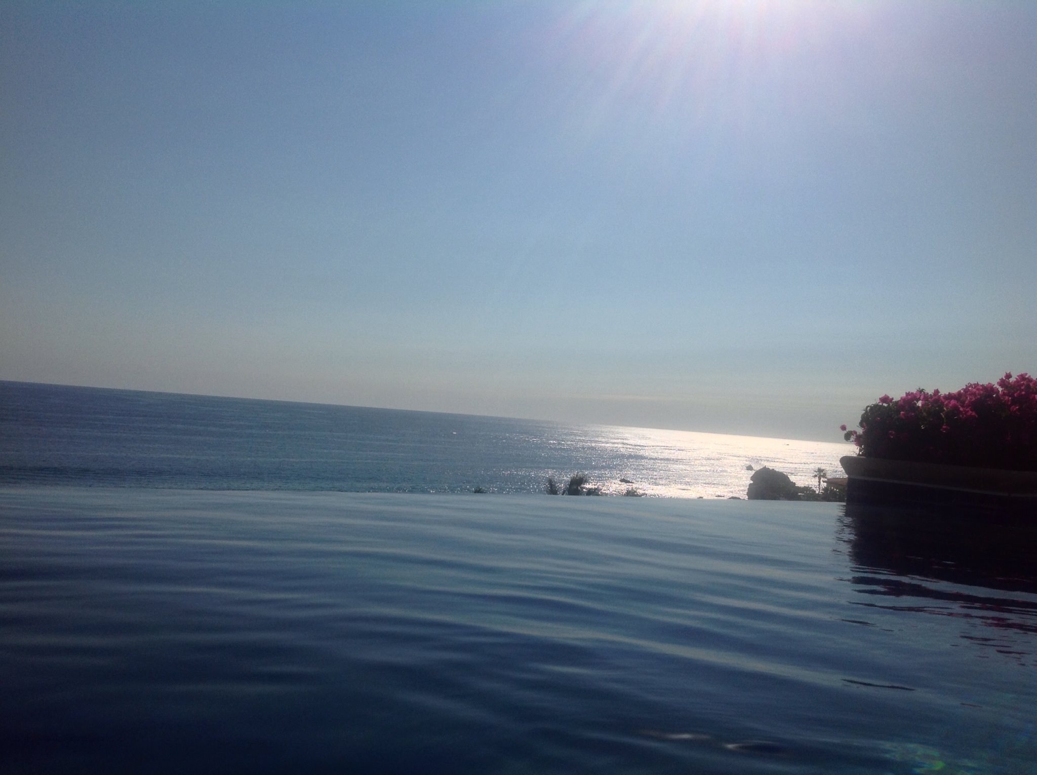 Infinity Pool overlooking the Pacific ocean at our private Villa in Pedregal, Cabo San Lucas